Ashland (Virginia)
| Ashland | ||
|---|---|---|
 Town Hall |
||
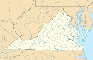
| Location in Virginia | ||
|
|
||
| Basic data | ||
| Foundation : | 1850 | |
| State : | United States | |
| State : | Virginia | |
| County : | Hanover County | |
| Coordinates : | 37 ° 46 ′ N , 77 ° 29 ′ W | |
| Time zone : | Eastern ( UTC − 5 / −4 ) | |
| Residents : | 6,619 (as of: 2000) | |
| Population density : | 355.9 inhabitants per km 2 | |
| Area : | 18.7 km 2 (approx. 7 mi 2 ) of which 18.6 km 2 (approx. 7 mi 2 ) is land |
|
| Height : | 65 m | |
| Postal code : | 23005 | |
| Area code : | +1 804 | |
| FIPS : | 51-03368 | |
| GNIS ID : | 1492492 | |
| Website : | www.town.ashland.va.us | |
| Mayor : | Faye O. Prichard | |
Ashland (formerly also Slash Cottage or Slashes ) is a small town with about 6600 inhabitants in the state of Virginia in the United States . It is located around 30 km north of Virginia's capital, Richmond, in Hanover County .
Ashland was founded in 1858 on a historically widely used route between Richmond and Washington , now Interstate 95 . Ashland has been the seat of Randolph-Macon College since 1830 .
In October 2002, Ashland hit the headlines as one of the crime scenes of the Beltway Sniper Attacks .
Web links
Commons : Ashland (Virginia) - Collection of images, videos, and audio files
- Official website of the city of Ashland ( English )
- Randolph-Macon College
Individual evidence
- ^ The American Guide Series, Compiled and Written by the Federal Writers' Project of the Work Projects Administration. A state by state guide series published by various publishers, in the late 1930's and 1940's. Each book studies and describes each state's history, natural endowments, and special interests. Use code US-T125 / Name / YYYY / p #. Virginia / p354
- ↑ James Hagemann: The Heritage of Virginia: the Story of Place Names in the Old Dominion . West Chester, Pennsylvania: Schiffer Publishing, 1988, p. 7.
