Auchnaclach
|
Auchnaclach Scottish Gaelic Achadh nan Clach |
||
|---|---|---|
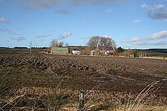
| Buildings in Auchnaclach | ||
| Coordinates | 55 ° 50 ′ N , 6 ° 8 ′ W | |
|
|
||
| administration | ||
| Post town | ISLE OF ISLAY | |
| ZIP code section | PA45 | |
| prefix | 01496 | |
| Part of the country | Scotland | |
| Council area | Argyll and Bute | |
| British Parliament | Argyll and Bute | |
| Scottish Parliament | Argyll and Bute | |
Auchnaclach , also Octnaclach , ( Gaelic : Achadh nan Clach , "field of stones") is a town in the east of the Scottish Hebridean island of Islay . Administratively it belongs to the Council Area Argyll and Bute . Auchnaclach is located directly on the A846 on its way from Port Askaig to Bridgend . Port Askaig is about 2.5 kilometers to the east and Bowmore , the main town on the island, is twelve kilometers to the southwest. The nearest town is Keills, one kilometer away . In 1841 there were 34 inhabitants in Auchnaclach. Ten years later the population had dropped to seven. Auchnaclach is not listed separately in current census data. Today Auchnaclach only consists of the premises of a transport company with a residential building. Auchnaclach is connected to the island's public transport system via its own stop.
Surroundings
A few hundred meters south of the village was once the small settlement Scanistle , also known as Scanastil or Scanlittle , which no longer exists today. To the east of Scanistle are the remains of an unknown medieval settlement.
Individual evidence
- ^ Information from the Scottish Parliament
- ↑ Scotland Census 1841
- ↑ Scotland Census 1851
- ↑ Entry on Scanistle in Canmore, the database of Historic Environment Scotland (English)

