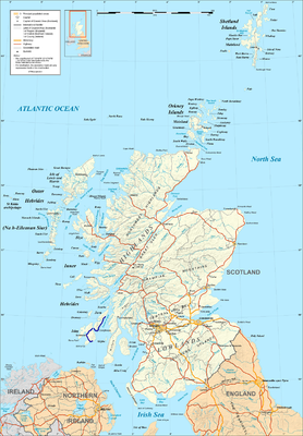
A846 road
| A846 road in the UK | |

|
|
| map | |
| Basic data | |
| Operator: | |
| Start of the street: |
Ardbeg ( 55 ° 39 ′ N , 3 ° 7 ′ W ) |
| End of street: |
Lussagiven ( 56 ° 1 ′ N , 5 ° 48 ′ W ) |
| Overall length: | 77 km (47.8 mi ) |
| The A846 between Port Ellen and Bowmore | |
|
Course of the road
|
|
The A846 is a road in Scotland . It runs across the two Hebridean islands of Islay and Jura and forms the main thoroughfare of both islands.
course
The A846 begins at Ardbeg on the south coast of Islay. It follows the coast in a westerly direction to Port Ellen . From there, it heads north near the coast of Laggan Bay and Loch Indaal to Bowmore . In a north-easterly direction it then continues to Bridgend , where the A847 branches off the second major road Islays, which leads via Port Charlotte to Portnahaven . The A846 keeps the rough direction northeast and finally reaches the ferry terminal Port Askaig via Ballygrant . The road continues in Feolin on the opposite bank of the Islay Sound on Jura. It follows the coastline of the island to the south and then again to the north and finally reaches Craighouse, the main town of the island. The A846 ends 23 km to the north and connects with several individual farms.
The A846 has two lanes between Port Ellen and Port Askaig. All other sections of the route are only single track road . With Port Ellen and Port Askaig, the road runs through the two ferry ports in Islays, so that all goods and passenger traffic to the Scottish mainland is handled through them. At Glenegedale it also connects to Islays Airport . With Feolin the road ends at the only regularly serviced ferry terminal on the island and is therefore of great infrastructural importance. Bowmore and Craighouse are the main towns on both islands on the A846.


