Balmets
| Balmets | ||
|---|---|---|
|
Bälmeten with snow from the Schattdorf side |
||
| height | 2414 m above sea level M. | |
| location | Canton of Uri , Switzerland | |
| Mountains | Glarus Alps | |
| Dominance | 1.83 km → Rinderstock | |
| Notch height | 162 m ↓ on the Bälmeter ridge | |
| Coordinates | 694 857 / 187 352 | |
|
|
||
| rock | lime | |
| First ascent | Presumably shepherds or hunters in prehistoric times | |
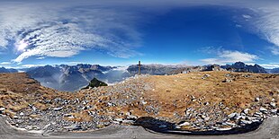
The Bälmeten is a 2414 m above sea level. M. high mountain in the Glarus Alps . Its summit ridge forms part of the border between the two communities Schattdorf and Erstfeld . Its summit is also the highest point in Schattdorf. It is located in the mountain range Wängihorn - Burg - Hoch Fulen - Bälmeten - Schwarz Grat, which surrounds the community of Schattdorf like two scenes set up at right angles.
Climbing opportunities
The Bälmeten is a well-climbed mountain with a view of the plain of the Urner Unterland and the upper Reuss valley . The two normal routes run from Schattdorf over Haldi - Butzenboden - to the Bälmeter Grätli, where they merge with the normal route from Erstfeld, which reaches this gap via Schwandi - Öfeli. From the Bälmeter Grätli, the mountain hiking trail follows the ridge to the large summit plateau. From the Bälmer Grätli there are also paths to the Seewlisee ( Silenen ), the Griesstal ( Unterschächen ) or the Hoch Fulen.
A third ascent route starts at the Schwarz Grat, at first only slightly ascending north around the summit and finally reaches the highest point via the north ridge. The route is pathless and partly exposed, there are blue-white markings. The most spectacular section is a natural rock bridge over a tunnel in the north ridge.
An ascent with touring skis or snowshoes is also possible, but depending on the avalanche situation, it is not entirely safe.
geology
The mountain range in which the Bälmeten lies is mainly formed by a mighty, steeply sloping, autochthonous Malm limestone plate. This formation is cut through by the Reuss and continues on the western side of the valley with the Geissberg and the Schlossberg. On the Erstfeld side, its foot already consists of the crystalline rock of the Aar massif.
Surname
The name Bälmeten comes from the Rhaeto-Romanic Balmita, which is the diminutive of Balm. Balmen are caves or protected spaces that are often used by animals as refuge. These cave-like rock formations are common here. There is even a tunnel.
swell
- Toni Fullin: Literature of the Urner Alps East . SAC Verlag 1992.
- National map of Switzerland 1: 25,000. Sheet 1192 Schächental
- http://www.top-of-uri.ch/


