Kalhausen – Sarralbe railway line
| Kalhausen – Sarralbe | |||||||||||||||||||||||||||||||||||||||||||||
|---|---|---|---|---|---|---|---|---|---|---|---|---|---|---|---|---|---|---|---|---|---|---|---|---|---|---|---|---|---|---|---|---|---|---|---|---|---|---|---|---|---|---|---|---|---|
|
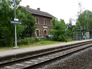
Herbitzheim station, 2015
| |||||||||||||||||||||||||||||||||||||||||||||
| Route number (SNCF) : | 169,000; 13 4 (1962); 232 (1917) | ||||||||||||||||||||||||||||||||||||||||||||
| Route length: | 8.0 km | ||||||||||||||||||||||||||||||||||||||||||||
| Gauge : | 1435 mm ( standard gauge ) | ||||||||||||||||||||||||||||||||||||||||||||
| Maximum slope : | 2 ‰ | ||||||||||||||||||||||||||||||||||||||||||||
| Dual track : | former | ||||||||||||||||||||||||||||||||||||||||||||
|
|||||||||||||||||||||||||||||||||||||||||||||
The Kalhausen – Sarralbe railway line (German actually Kalhausen-Saaralben railway line ) was an eight-kilometer short, most recently single-track , non-electrified connection between the two stations of the municipalities of Sarralbe and Kalhausen in the Moselle department in Lorraine . The only stop in between, however, was in the Bas-Rhin department , Alsace .
history
The line went into double-track operation on May 1, 1895 at the same time as the Mommenheim – Kalhausen line. Just like this, it was built and operated by the Imperial General Directorate of Railways in Alsace-Lorraine . With the surrender after the First World War, it went to the Chemins de fer d'Alsace et de Lorraine and was taken over by the SNCF in 1938 . In the time of the Germans it belonged as a section to the railway line 232 Saargemünd – Bensdorf – Moncel – Nancy, which was changed under French administration to the railway line 13 and 13 9 , later 097 000 Champigneulles – Sarralbe with continuation to Saargemünd (13 7 ). It was later added to route 13 4 (Sarreguemines – Berthelming) and reduced to one track in the 1970s. Even if they still have different route numbers today and the tracks between Sarre-Union and Berthelming have been dismantled, trains run continuously on the entire section.
description
The route runs along the right bank of the Saar and has no height differences to overcome. Nevertheless, considerable amounts of earth had to be moved for the construction, as it is led on a railway embankment between Herbitzheim and Kalhausen, which made longer road tunnels necessary to cross the roads. The glans is also artificially bridged shortly before its mouth.
Web links
- Map of the Imperial Railways in Alsace-Lorraine and the Wilhelm-Luxemburg-Railways. with planned route, 1894
- Map of the Imperial Railways in Alsace-Lorraine and the Wilhelm-Luxemburg-Railways. with completed line, 1906
Individual evidence
- ↑ SNCF: Region de l'est. Carnet de Profils et Schémas , 1962, sheet 78
- ^ Reichs-Kursbuch, Edition 2, Julius Springer, Berlin 1917, table 232
- ↑ Reinhard Douté: Les 400 profils de lignes voyageurs du réseau français: lignes 001 à 600 , in: La Vie du Rail 2011, Volume 1, Page 76, ISBN 978-2-918758-34-1
- ↑ Annales de l'Est , Fédération historique lorraine, Université de Nancy et Faculté des lettres, Nancy 1963, page 218
- ↑ Werner Matthias Ried: Infrastructure and development potential of the railways in SaarLorLux. Paths from marginalization to sustainable mobility in the greater region. , Dissertation, St. Ingbert 2014, page 175
