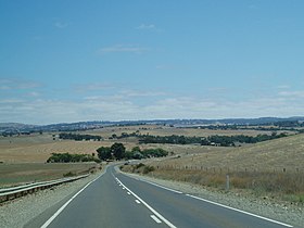
Barossa Valley Highway
| Barossa Valley Highway | |||||||||||||||||||||||||||||||
|---|---|---|---|---|---|---|---|---|---|---|---|---|---|---|---|---|---|---|---|---|---|---|---|---|---|---|---|---|---|---|---|

|
|||||||||||||||||||||||||||||||
| Basic data | |||||||||||||||||||||||||||||||
| Operator: | Transport SA | ||||||||||||||||||||||||||||||
| Start of the street: |
Gawler ( SA ) ( 34 ° 36 ′ S , 138 ° 45 ′ E ) |
||||||||||||||||||||||||||||||
| End of street: |
north of Nuriootpa ( SA ) ( 34 ° 27 ′ S , 139 ° 0 ′ E ) |
||||||||||||||||||||||||||||||
| Overall length: | 34 km | ||||||||||||||||||||||||||||||
|
States : |
|||||||||||||||||||||||||||||||
| Barossa Valley Highway | |||||||||||||||||||||||||||||||
|
Course of the road
|
|||||||||||||||||||||||||||||||
The Barossa Valley Highway (also Barossa Valley Way ) is a major road in the center of the Australian state of South Australia . It connects the Main North Road at Gawler with the Sturt Highway at Nuriootpa .
course
In Gawler, the Barossa Valley Highway branches off the Main North Road (A32) to the east. It leads over Sandy Creek to Lyndoch , the first settlement in the Barossa Valley wine-growing region . There the road, designated as B19, turns northeast and from Rowland Flat essentially follows the south bank of the North Para River via Tanunda to Nuriootpa.
In Nuriootpa the Barossa Valley Highway crosses the North Para River and meets the Sturt Highway (NA20) about 2 km further north.
Web links
source
Steve Parish: Australian Touring Atlas . Steve Parish Publishing. Archerfield QLD 2007. ISBN 978-1-74193-232-4 . P. 65

