Bartang
|
Bartang Барта́нг |
||
|
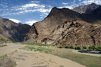
The mouth of the tributary Jezevdara (right) into the Bartang (left) |
||
| Data | ||
| location | Mountain Badakhshan ( Tajikistan ) | |
| River system | Amu Darya | |
| Drain over | Pandsch → Amu Darya → Aral Sea (temporarily) | |
| Confluence of |
Murgab and Kudara 38 ° 19 ′ 14 " N , 72 ° 27 ′ 23" E |
|
| Source height | 2595 m | |
| muzzle | Above Ruschan in the Pandsch Coordinates: 37 ° 55 '21 " N , 71 ° 35' 24" E 37 ° 55 '21 " N , 71 ° 35' 24" E |
|
| Mouth height | 1979 m | |
| Height difference | 616 m | |
| Bottom slope | 4.6 ‰ | |
| length | 133 km (with source rivers Murgab and Aksu 528 km) | |
| Catchment area | 24,700 km² | |
| Drain |
MQ |
128 m³ / s |
| Left tributaries | Bardara | |
|
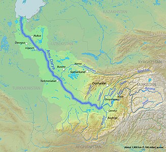
Location of the Bartang in the catchment area of the Amu Darya |
||
|
Hydrological catchment areas in Eastern Tajikistan |
||
The Bartang ( Russian Барта́нг ) is a 133 km long right tributary of the Pandsch in the autonomous province of Berg-Badachschan in eastern Tajikistan .
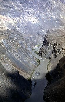
The Bartang arises centrally in Berg-Badachschan at an altitude of 2595 m in the Pamir Mountains through the confluence of the Murgab and Kudara, west of Barchidev . To the west it flows mostly within the Tajik National Park , after which it flows into the Pandsch at Vomar at an altitude of 1979 m . It separates the Jasgulem chain in the north from the Ruschan chain in the south.
The border with Afghanistan is on the other, western bank of the Pyanj and thus opposite the confluence of the Bartang, which is mainly fed by water from melted glaciers and snow .
Web links
Individual evidence
- ↑ a b Article Bartang in the Great Soviet Encyclopedia (BSE) , 3rd edition 1969–1978 (Russian)


