Murgab (Bartang)
|
Murgab Мургаб, Оксу, Aksu, Oksu |
||
|
|
||
| Data | ||
| location |
Badakhshan ( Afghanistan ), Mountain Badakhshan ( Tajikistan ) |
|
| River system | Amu Darya | |
| Drain over | Bartang → Pandsch → Amu Darya → Aral Sea (temporarily) | |
| source | in the Wachan Corridor in the far east of Afghanistan, 37 ° 21 ′ 29 ″ N , 74 ° 24 ′ 40 ″ E |
|
| Source height | 4015 m | |
| muzzle | west of Barchidev with the Kudara to Bartang Coordinates: 38 ° 19 '14 " N , 72 ° 27' 23" E 38 ° 19 '14 " N , 72 ° 27' 23" E |
|
| Mouth height | 2595 m | |
| Height difference | 1420 m | |
| Bottom slope | 3.6 ‰ | |
| length | 395 km | |
| Left tributaries | Istyk | |
| Reservoirs flowed through | Saressee | |
| Small towns | Murgab | |
|
Usoi Dam |
||
|
Hydrological catchment areas in Eastern Tajikistan |
||
The Murgab ( Russian Мургаб ; in the upper reaches Оксу ( Aksu or Oksu ) called) is the 395 km long headwaters of the Bartang in Afghanistan and Tajikistan ( Central Asia ).
course
The river arises as Aksu or Oksu not far from the interface of the Hindu Kush and Pamir mountains in the extreme northeast of Badachschan, which belongs to Afghanistan . In there after the river Wakhan River named Wachanzipfel entfließt the Aksu long one and several kilometers of glaciers fed lake in approximately 4015 m height; the Wachandarja rises in the same high mountain valley, but flows in the opposite direction. The Aksu flows to the northeast, with its water crossing the border to Tajikistan and thus to the Berg-Badakhshan region after just a few kilometers . From then on flowing northward in the Pamir, the river reaches the high mountain villages Shaimak and Tokhtomush , after which it gradually turns west.
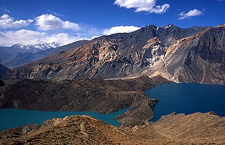
From the city of Murgab , which is 3612 m above sea level , the flowing water is called Murgab . From there it runs westwards through the Pamir and flows a little later through the Saressee , which was created on February 18, 1911 by a huge landslide triggered by an earthquake . The natural dam is named Usoi Dam . Only a little below this natural reservoir or to the west of Barchidev , the water of the Murgab joins the Kudara at around 2595 m above sea level to form the Bartang .
Web links
Individual evidence
- ↑ Article Bartang in the Great Soviet Encyclopedia (BSE) , 3rd edition 1969–1978 (Russian)

