Bathmen
 flag |
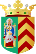
 coat of arms |
| province |
|
| local community |
|
| Residents | 5,570 (Jan 1, 2017) |
| Coordinates | 52 ° 15 ′ N , 6 ° 17 ′ E |
| Important traffic route |
|
| prefix | 0570 |
| Postcodes | 7216, 7428, 7434-7435, 7437, 7451 |
| Location of Bathmen in the parish of Deventer | |
Bathmen is a village in the Dutch province of Overijssel . The municipality of Bathmen was merged on January 1, 2005 with the larger neighboring village of Deventer to form the municipality of Deventer.
The village of Bathmen is 26.42 km² and has 5,570 inhabitants (as of January 1, 2017).
Bathmen is located on the Amsterdam-Osnabrück motorway and is rich in small forests and old farms.
The partner municipality is Westerkappeln in the Tecklenburger Land (Germany).
Web links
Commons : Bathmen - collection of images, videos and audio files
Individual evidence
- ↑ a b Kerncijfers wijken en buurten 2017 Centraal Bureau voor de Statistiek , accessed on March 31, 2018 (Dutch)
