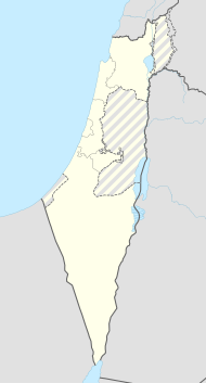
Beer Tuvia (regional administration)
| Beer Tuvia | ||
|---|---|---|

|
||
| Basic data | ||
| hebrew : | מועצה אזורית באר טוביה | |
| State : |
|
|
| District : | south | |
| Founded : | 1950 | |
| Coordinates : | 31 ° 46 ' N , 34 ° 43' E | |
| Area : | 140 km² | |
| Residents : | 21,900 (2014) | |
| Population density : | 156 inhabitants per km² | |
| Time zone : | UTC + 2 | |
| Community type: | Regional administration | |
| Mayor : | Dror Schor (דרור שור) | |
| Website : | ||
|
|
||
The Beer Tuvia Regional Administration ( Hebrew מוֹעָצָה אֲזוֹרִית בְּאֵר טוֹבְיָה (מועצה אזורית באר טוביה) Mo'aza Asorit Beer Towja) is an Israeli regional administration founded in 1950 in the southern district of Israel .
Surname
The regional administration is named after the Israeli town of Beer Towja ( Hebrew בְּאֵר טוֹבְיָה; German: Well of Tobias) named. The place itself was originally called Beer Tuw-Ja ( Hebrew באר טוּב-יה) but was named after the book Tobias ( Hebrew סֵפֶר טוֹבְיָה) in Beer Towja ( Hebrew בְּאֵר טוֹבְיָה) renamed.
Demographics
21,900 people live in the 140 km² area of the regional administration (as of 2014).
The Israeli Central Bureau of Statistics reports the following population figures for the regional administration:
| Year of the census | 1961 | 1972 | 1983 | 1995 | 2008 |
| Number of inhabitants | 9,300 | 8,900 | 9,600 | 12,800 | 19,000 |
structure
In 1971 the regional association founded the Achwa University of Applied Sciences ( Hebrew המִכְלָלָה האָקָדֶמִית אַחֲוָה) at the place Achwa ( Hebrew אַחֲוָה, Achawa means in German: brotherhood) in the northern Negev desert in the southern district of Israel .
The regional administration is responsible for a kibbutz , 19 moshavim , a community settlement , a youth village, the village of Achawa (אַחֲוָה) and the four industrial zones: Kannot, Beer Tuvia, Ad Halom and Mivza - Reem.
|
Kibbutzim
|
Moshavim
|
Community settlements
|
Youth Villages
|
Web links
- Official Website (Hebrew)
Individual evidence
- ↑ Official website
- ↑ בְּאֵר טוֹבְיָה on ravdori.co.il.
- ^ Israel Central Bureau of Statistics
- ↑ achva.ac.il
