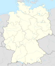
Benhorn
Coordinates: 52 ° 47 ′ 43 " N , 9 ° 44 ′ 6" E
Benhorn was a village in the old district of Fallingbostel , located in the Heidmark in Lower Saxony . It belonged to the municipality of Ettenbostel . Today, Ettenbostel is a residential area in the Hartem district in the community-free area Osterheide , in the Heidekreis district , (Lower Saxony).
history
In 1330 Benhorn was first mentioned in a document from the historian Sudendorf . The place is named after the settlement of the Benno clan ( Longobard personal name). The estate in Benhorn is also mentioned in this document. The farmers lived mainly from keeping the Heidschnucken and from beekeeping.
The local researcher Hans Stuhlmacher describes the Mühlengrund, a dry valley east of Benhorn in the direction of Sieben Steinhäuser , as "the most beautiful prehistoric landscape of the old Fallingbostel district. During the construction of the Bergen military training area , the population was resettled and the entire area cleared from summer 1935 to May 1936. The farm owners were compensated, most of the buildings were demolished (see Heidmark # Destruction of the Ostheidmark in the time of National Socialism )
Population development
Ettenbostel and Benhorn had the following population development:
1770 - 121 inhabitants
1821 - 158 inhabitants
1933 - 173 inhabitants
swell
- Hans Stuhlmacher : The Heidmark. Schneeheide 1939
- Hinrich Baumann: The Heidmark - Change of a Landscape. The history of the Bergen Training Area. 2006


