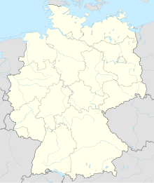
Ettenbostel
Coordinates: 52 ° 47 ′ 34 " N , 9 ° 42 ′ 21" E
Ettenbostel is a residential area in the Hartem district in the community-free area of Osterheide , in the Heidekreis district , ( Lower Saxony ). Ettenbostel was a municipality in Ostheidmark in the old district of Fallingbostel . The villages Benhorn and Mengdorf also belonged to the community.
history
Ettenbostel was once called Ettingeborstelde and was first mentioned in 1218 in document 9 of the Walsrode monastery . The old name is translated as Etto farmers , hence a clan settlement after the clan elder Etto. In the treasury register of Celle in 1438 five farms are already recorded for this place. Due to its location on a main traffic route, Ettenbostel suffered particularly badly during the Thirty Years' War , but recovered from it very quickly.
In 1330, Benhorn is still called “ Benninghehorne ” (the settlement of the Benno clan), which is a Longobard personal name. The historian Sudendorf records the oldest information about the place in document 495, volume 1. In 1330, the squire Johann von Vulle allows the dukes Otto III and Wilhelm II of Braunschweig-Lüneburg to redeem the Benhorn estate.
The local historian Hans Stuhlmacher denotes the mill base, a dry valley east of Ettenbostel and Benhorn towards Seven stone houses , as the " most beautiful Urheidelandschaft the former district Fallingbostel. The moorland farmers ensured their survival through the Schnuckenhaltung . Only when in the 19th century succeeded the hardpan to break down and To cultivate arable soils, the marl was discovered, artificial and green manure emerged, the Heidschnucken moved into the background. (See Development of Agriculture in the Heidmark )
In the course of the establishment of the Bergen military training area , the resettlement of the population and the evacuation of the entire area took place from summer 1935 to May 1936. The farm owners were compensated, the buildings were mostly demolished. (See Heidmark # Destruction of Ostheidmark in the time of National Socialism ) The total size of the municipal area was 1345 hectares , of which 750 hectares fell into the military training area.
Population development
Ettenbostel and Benhorn had the following population development:
1770 - 121 inhabitants
1821 - 158 inhabitants
1933 - 173 inhabitants
literature
- Hinrich Baumann: The Heidmark. Change of a landscape. The history of the Bergen Training Area. 2005, ISBN 3-00-017185-1 .
- Hans Stuhlmacher : The Heidmark. Publisher CM Engelhardt, Hanover


