Bernese Au
| Bernese Au | ||
| Data | ||
| location | northeast Hamburg | |
| River system | Elbe | |
| Drain over | Wandse → Alster → Elbe → North Sea | |
| source | south of the Saseler Weg in Hamburg-Volksdorf 53 ° 38 ′ 49 ″ N , 10 ° 8 ′ 41 ″ E |
|
| muzzle | north of the Ostend pond in Hamburg- Farmsen / Tonndorf in the Wandse coordinates: 53 ° 35 ′ 32 ″ N , 10 ° 6 ′ 56 ″ E 53 ° 35 ′ 32 ″ N , 10 ° 6 ′ 56 ″ E
|
|
| length | 8.3 km | |
| Big cities | Hamburg | |
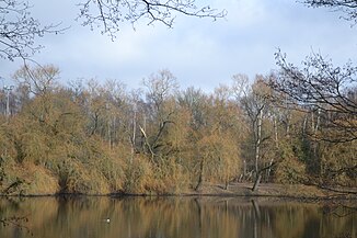
The Berner Au is a Hamburg stream. It flows through the outer northeast of the urban area.
geography

The brook has no actual source and forms in a meadow area south of the Saseler Weg in the Volksdorf district of Hamburg . It flows in a south-westerly direction, crosses the districts of Sasel and Farmsen-Berne and flows into the Wandse after 8.3 km at the Ostend pond , which in turn flows over the Alster to the Elbe . The Bernese Au is thus a 4th order body of water. In terms of tributaries, the Klosterwiesengraben, Deepenhorngraben , Karlshöher Graben and the Wellingsbütteler Grenzgraben are worth mentioning.
In 2014, almost the entire course of the stream was declared a floodplain by the Hamburg Authority for Urban Development and the Environment, which restricts the structural and creative use of neighboring properties.
description
The course of the water is predominantly characterized by green belts, allotment gardens, forests and meadows and accompanied by footpaths in the lower half. The upper course of the stream often falls dry in the summer months. Many earlier hydraulic engineering interventions have been reversed in recent years. Efforts have been made to restore the lower third of the course of the brook by creating rushing and floodplains in a natural way. In contrast, the upper reaches remained in their natural state. A leaflet published by the Wandsbek district office in Hamburg (see below) describes a hike from the Trabrennbahn underground station to the Volksdorf underground station near the stream.
History
The brook used to be called Farmsenerbek or Farmsener Bach. The actual origin is said to have been the "Big Pond" in Volksdorf, whereby today's pond meadow waters flow off towards Saselbek . It seems possible that the Berner Au used to flow from Farmsen west to Osterbek and that today's lower course of the brook was forced through a puncture because of the construction of a mill on the copper pond . One such can be found there as early as 1480, it was used to manufacture copper sheets using a water-powered hammer and was converted into a grain mill in 1810. In place of the old mill weir there is now a semi-automatic weir. In addition, there used to be a powder , saw and fulling mill nearby .
literature
- City map of Hamburg / City map of Hamburg on DVD, 2nd expanded and updated edition; State Office for Geoinformation and Surveying Hamburg
- Wandsbeker tours 2: Berner Au; District Office Hamburg-Wandsbek
- W. Melhop: The Alster; Paul Hartung Verlag, Hamburg 1932 (Reprint K. Heymann, Hamburg)
- 700 years Volksdorf, M + K Hansa Verlag, Hamburg 1996


