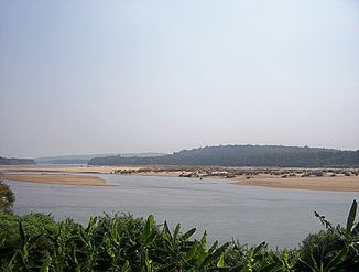
Bharathapuzha
| Bharathapuzha | ||
|
Lower Bharathapuzha |
||
| Data | ||
| location | Kerala , Tamil Nadu (India) | |
| River system | Bharathapuzha | |
| source | in the Western Ghats in Tamil Nadu 10 ° 36 ′ 0 ″ N , 77 ° 7 ′ 0 ″ E |
|
| Source height | 2461 m | |
| muzzle | in the Arabian Sea Coordinates: 10 ° 47 ′ 10 " N , 75 ° 54 ′ 45" E 10 ° 47 ′ 10 " N , 75 ° 54 ′ 45" E |
|
| Mouth height | 0 m | |
| Height difference | 2461 m | |
| Bottom slope | 12 ‰ | |
| length | 209 km | |
| Catchment area | 6186 km² | |
| Outflow at the estuary level |
MQ |
161 m³ / s |
| Medium-sized cities | Pollachi , Shoranur , Ponnani | |
|
Location of the Bharathapuzha |
||
The Bharathapuzha ( Malayalam ഭാരതപ്പുഴ IAST Bhāratappuḻa [ ˈbʱaːɾat̪əpːuɻa ]; also: Ponnani or Nila called) is a coastal river in the southern Indian state of Kerala .
course
The approx. 209 km long river rises at an altitude of 2461 m in the Western Ghats in Tamil Nadu and flows through the districts of Palakkad and Malappuram before it flows into the Arabian Sea north of the city of Ponnani .
Tributaries and reservoir
The Bharathapuzha has numerous major and minor tributaries. Its course is interrupted by six dams, and two more plants are under construction. They are mainly used for irrigation, there is also a drinking water supply project.
Web links
Commons : Bharathappuzha - collection of images, videos and audio files

