Big Woody Island
| Big Woody Island Tooliewah |
||
|---|---|---|
| Big Woody Island Lighthouse Keeper's House (1906) | ||
| Waters | Great Sandy Strait | |
| Archipelago | Woody Islands | |
| Geographical location | 25 ° 18 '16 " S , 152 ° 58' 9" E | |
|
|
||
| length | 8.8 km | |
| width | 1.4 km | |
| surface | 6.6 km² | |
| Highest elevation | 80 m | |
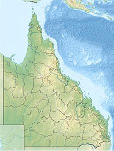
| Topographic map sheet with Woody Island | ||
The islands Big Woody Island or just Woody Island , in the Aboriginal language of the Butchulla Tooliewah , and Little Woody Island or Walangoora are located in the Great Sandy Strait , a strait between Hervey Bay and Fraser Island in Queensland , Australia .
geography
Big Woody Island is located about five kilometers east of Urangan, an eastern part of the Australian mainland city of Hervey Bay . The island has an area of 660 hectares . The island is long and narrow, it stretches in a northwest-southeast direction. With a length of 8.8 km, it is a maximum of 1400 and an average of 750 meters wide. The island is densely forested. The central ridge running lengthways through the island reaches a height of 80 meters. The slopes to the west coast are not steep, those to the east coast are very steep, with rock formations. Both islands are uninhabited and can only be reached by private boats. They are located in Great Sandy National Park and have rocky coastal landscapes that are fringed by mangroves . Numerous species of birds live on the forested islands.
Big Woody Island
On Big Woody Iceland are two lighthouses that were built in 1866 and put into operation 1867th The wooden lighthouses, Middle Bluff Lighthouse and North Bluff Lighthouse , which are among the oldest buildings in Queensland, and associated buildings are inscribed on the Queensland List of Historic Monuments. The lighthouses are considered an important historical testimony to the separation of Queensland from New South Wales as an independent state. Next to the lighthouses are the ruins of the lighthouse keeper's house, tombstones, telegraph systems and a fish ladder created by the local Aborigines. On the occasion of the 150th anniversary of the commissioning of the lighthouses, which is due in 2017, the Queensland government has commissioned a restoration of the entire structural ensemble.
The two small islands Picnic Island and Duck Island are 1200 and 2100 meters south of Big Woody Island .
On the southeast side of the island is Jeffries Beach with a campsite. This campsite has no structural facilities. Tourists have to take care of themselves.
Little Woody Island
Little Woody Island ( Walangoora ) is located 2,700 meters southeast of Big Woody Island . About two kilometers to the east of the small island is the the UNESCO - World Heritage counting Fraser Iceland. There is a rocky reef to the south of the islet and sandbars to the north. The bird species on this island are extremely worthy of protection, as they visit them as resting places or to eat. Therefore camping is not allowed on this island. However, fishing is not prohibited.
Individual evidence
- ^ Queensland Government: Woody Island Lighthouses & Ancillary Building Site
- ↑ Woody Is - Great Sandy National Park ( September 15, 2016 memento in the Internet Archive ), on frasercoastonline.com.au. Retrieved September 10, 2016
- ↑ Woody Island Lighthouses & Ancillary Building Site , at environment.ehp.qld.au. Retrieved September 10, 2016
- ↑ Mitch Crawley: Condition of lighthouse on Big Woody Island deteriorating. In: frasercoastchronicle.com.au. October 30, 2013, accessed October 26, 2018 .
- ↑ Woody Island and Little Woody Island, Great Sandy National Park , on nprs.qld.gov.au. Retrieved September 10, 2016


