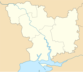
Bilousivka (Voznesensk)
| Bilousivka | ||
| Білоусівка | ||

|
|
|
| Basic data | ||
|---|---|---|
| Oblast : | Mykolaiv Oblast | |
| Rajon : | Voznesensk Raion | |
| Height : | 47 m | |
| Area : | 3.429 km² | |
| Residents : | 1,274 (2001) | |
| Population density : | 372 inhabitants per km² | |
| Postcodes : | 56576 | |
| Area code : | +380 5134 | |
| Geographic location : | 47 ° 25 ' N , 31 ° 32' E | |
| KOATUU : | 4822080401 | |
| Administrative structure : | 1 village | |
| Address: | вул. Димитрова 9 56576 с. Білоусівка |
|
| Statistical information | ||
|
|
||
Biloussiwka ( Ukrainian Білоусівка ; Russian Белоусовка Beloussowka ) is a village in the Ukraine Mykolaiv Oblast with about 1500 inhabitants (2001).
The village, first mentioned in writing in 1746, is located on the bank of the Southern Bug and has belonged to the rural municipality of Doroshiwka in the south of Voznesensk Raion since 2017 .
The regional road P-06 running east of the village leads to the Voznesensk district center after 26 km in a north-westerly direction and after 68 km in a south-easterly direction the city center of the Oblast capital Mykolaiv .
Individual evidence
- ↑ Village website on the official website of the Verkhovna Rada ; accessed on June 7, 2017 (Ukrainian)
- ↑ website of the rural municipality Doroschiwka ; accessed on September 23, 2018 (Ukrainian)


