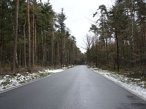
Birgter mountain
| Birgter mountain | ||
|---|---|---|
|
The Riesenbeck Postweg on the summit of the Birgter Mountain |
||
| height | 132 m above sea level NN | |
| location | Tecklenburger Land , Steinfurt District , North Rhine-Westphalia ( Germany ) | |
| Coordinates | 52 ° 15 '49 " N , 7 ° 39' 54" E | |
|
|
||
The Birgter Berg is located east of Riesenbeck between Rheine and Osnabrück in the Osningsandsteinzug, near the village of Birgte . It lies at the north-western end of the Teutoburg Forest and is 131.8 m above sea level. NN one of the first barriers for south-west and west-moving rain clouds, which explains the relatively humid climate. The Birgter Berg forms together with the Riesenbecker Berg , Lagerberg and Bergeshöveder Berg the Riesenbecker Osning. This division of the Teutoburg Forest is limited to the west by the Gravenhorster gorge. In the east through a cut on Dörenther Berg through which the federal road 219 runs.
Web links
Commons : Birgter Berg - Collection of images, videos and audio files

