Bjelolasica
| Bjelolasica | ||
|---|---|---|
|
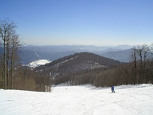
Panorama of Bjelolasica |
||
| height | 1533 m. i. J. | |
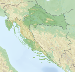
| location | Gorski Kotar | |
| Mountains | Dinaric mountains | |
| Coordinates | 45 ° 15 '39 " N , 14 ° 58' 48" E | |
|
|
||
The Bjelolasica is with 1533 m. i. J. (according to other information 1534 m ) highest mountain of Velika Kapela in the Dinaric Mountains around 30 km west of Ogulin in Croatia .
geography
The mountain is located in the Gorski Kotar landscape in a forest-covered and sparsely populated region and can be reached via the road from Ogulin to Novi Vinodolski ; at Jasenak a road branches off to Vrelo below the main summit Kula ("tower"). From the west, access is via Tuk Mrkopaljski or Begovo Razdolje, which can be reached from the A 6 motorway via Delnice . To the south are the nature reserves Bijele and Samarske stijene . The ridge, which is around six kilometers long and extends from northwest to southeast, is almost unforested.
fauna
The fauna includes wolves , brown bears and lynxes .
Tourism and sport
Nearby, in Vrelo, there is the winter sports area of the same name with the Hrvatski olimpijski centar Bjelolasica (Croatian Olympic Center), which with three double chair lifts and three ski lifts as well as seven slopes is to include the largest ski area in Croatia. The mountain ridge can be easily reached on foot on marked paths via forest paths. On a clear day, the view from the summit extends to the Julian Alps . In the vicinity of the summit is the unmanaged shelter Planinarsko skloniste Jakob Mihelcic at an altitude of 1460 m ; The Jancarica hut is about 45 minutes away. Further huts are available further away.

