Black Lyne
| Black Lyne | ||
|
The Black Lyne |
||
| Data | ||
| location | Cumbria , England | |
| River system | River Esk (Solway Firth) | |
| Drain over | River Lyne (River Esk) → River Esk (Solway Firth) → Solway Firth → Irish Sea | |
| River basin district | Solway Tweed XRBD | |
| source | south of Glendhu Hill 55 ° 9 ′ 44 ″ N , 2 ° 41 ′ 14 ″ W |
|
| muzzle | Confluence with the White Lyne coordinates: 55 ° 2 '57 " N , 2 ° 47' 26" W 55 ° 2 '57 " N , 2 ° 47' 26" W.
|
|
| Right tributaries | Bailey Water | |
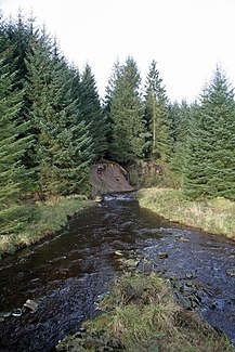
The Black Lyne is a watercourse in Cumbria , England . It arises south of Glendhu Hill . It initially flows south until it turns west at the hamlet of Holmehead . At the mouth of the Bailey Water , the Black Lyne turns south again and flows in this way until it forms the River Lyne when it meets the White Lyne .
Web links
Commons : Black Lyne - collection of images, videos and audio files
