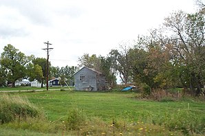
Blanchard, North Dakota
| Blanchard | ||
|---|---|---|
 Typical street in Blanchard |
||
| Location in North Dakota | ||
|
|
||
| Basic data | ||
| Foundation : | 1881 | |
| State : | United States | |
| State : | North Dakota | |
| County : | Traill County | |
| Coordinates : | 47 ° 22 ′ N , 97 ° 16 ′ W | |
| Time zone : | Central ( UTC − 6 / −5 ) | |
| Residents : | 84 (status: 2000) | |
| Population density : | 0.9 inhabitants per km 2 | |
| Area : | 93.2 km 2 (approx. 36 mi 2 ) of which 93.2 km 2 (approx. 36 mi 2 ) is land |
|
| Height : | 294 m | |
| Postal code : | 58009 | |
| Area code : | +1 701 | |
| FIPS : | 38-07660 | |
| GNIS ID : | 1036685 | |
Blanchard is a small community in Traill County in the US state of North Dakota . Blanchard is near the Minnesota border .
Blanchard has an area of 85 km² and 92 inhabitants.
Five kilometers west of Blanchard is the approx. 629 m high KVLY mast , the fourth highest structure on earth and the highest transmission mast in the world.
