Blea Water
| Blea Water | ||
|---|---|---|

|
||
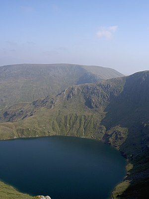
| Blea Water with the Harter Fell in the background | ||
| Geographical location | Cumbria , England , UK | |
| Drain | Blea Water Beck | |
| Data | ||
| Coordinates | 54 ° 29 '20 " N , 2 ° 51' 10" W | |
|
|
||
| Altitude above sea level | 488 m | |
| length | 530 m | |
| width | 470 m | |
| Maximum depth | 63 m | |
|
particularities |
deepest tarn in the Lake District |
|
The Blea Water is a roughly circular mountain lake or tarn in the Lake District , Cumbria , England . The lake is also artificially dammed by a small wall and with a depth of 63 m is the deepest of all small mountain lakes and is only surpassed by Windermere and Wastwater .
The lake is located on the southeast flank of High Street and above the lake called Small Water .
The water has few nutrients and therefore there are almost no plants in the lake. The plants represented in the lake, such as a type of water star (Callitriche hamulata), European beach lingon and candelabrum algae (Nitella flexilis) are typical for such water conditions. The lake has been a Site of Special Scientific Interest since 1984 .
The Blea Water Beck forms its drain on the southeast side of the lake.
See also
Web links
Individual evidence
- ↑ Blea Water on SSSI List from Natural England
