Blountsville, Alabama
| Blountsville | |
|---|---|
|
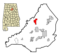
Location in Alabama and County
|
|
| Basic data | |
| Foundation : | 1818 |
| State : | United States |
| State : | Alabama |
| County : | Blount County |
| Coordinates : | 34 ° 5 ′ N , 86 ° 35 ′ W |
| Time zone : | Central ( UTC − 6 / −5 ) |
| Residents : | 1,684 (as of 2010) |
| Population density : | 120.3 inhabitants per km 2 |
| Area : | 14.2 km 2 (approx. 5 mi 2 ) of which 14.0 km 2 (approx. 5 mi 2 ) is land |
| Height : | 217 m |
| Postal code : | 35031 |
| Area code : | +1 205 |
| FIPS : | 01-07456 |
| GNIS ID : | 0114510 |
Blountsville is a town in Blount County in the state of Alabama in the United States .
geography
Blountsville is located in northern Alabama in the southeastern United States.
Nearby locations include Cleveland (2 miles south), Holly Pond (4 miles north), Hanceville (7 miles west), Garden City (8 miles southwest), and Susan Moore (8 miles east). The next larger city with 212,000 inhabitants is about 43 kilometers south of Birmingham .
history
Before the city was founded, the area was known as the Wassausey Indian settlement . The town was founded in 1816 as the Bear Meat Cabin and was renamed to its current name in 1825 when the post office opened. Blountsville was the county seat until 1889 , before the county was moved to Oneonta . Even in the early years there were numerous schools in the city, in 1833 a courthouse and a prison were built.
The city is named after Willie Blount, the fourth governor of Tennessee.
traffic
The city is crossed by US Highway 231 and affected in the south by Alabama State Route 79 . Both connect to US Highway 278 in the north. Interstate 65 runs about 15 miles west of the city .
About 30 kilometers northwest is the Cullman Regional Airport-Folsom Field , 54 kilometers southwest also the Birmingham-Shuttlesworth International Airport .
Demographics
The 2000 census showed a population of 1768, divided into 743 households and 479 families. The population density was 326 people per square kilometer. 89.5% of the population were white, 0.8% American Indian, 0.3% Asian and 0.1% Pacific islander. 8.2% were of a different ethnicity , 1.1% had two or more races, and 16.2% were Hispanic or Latin American of any ethnicity. For every 100 women there were 95 men. The median age was 37 and the per capita income was $ 13,426, which is 25.5% of the population below the poverty line.
By the 2010 census , the population had dropped to 1,684.
