Bodélé depression
| Bodélé depression | ||
|---|---|---|

|
||
| Dust storm in the Bodélé Depression; Lake Chad below left . The image width corresponds to 850 km. | ||
| Geographical location | Borkou , Chad | |
| Tributaries | Bahr el-Ghazal | |
| Data | ||
| Coordinates | 17 ° 2 ' N , 18 ° 13' E | |
|
|
||
| surface | 35,000 km² | |
|
particularities |
Former lake; Endorheic pelvis |
|
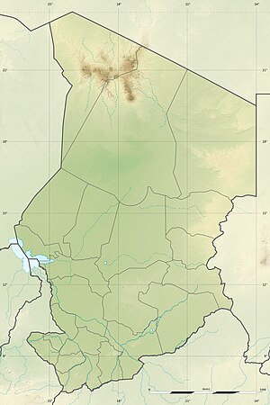
The Bodélé Depression is an endorheic depression and sedimentary basin in central Chad on the southern edge of the Sahara . In earlier climates with higher precipitation, this depression was a catchment basin for the water overflowing from Lake Chad in Bahr el-Ghazal .
location
In the north and northeast, the Bodélé Depression is bounded by the Tibesti Mountains or the wind corroded area of Borkou, in the west by the Erg du Bilma and in the east and south by the desert area of the Erg du Djourab .
This area covers an area of approximately 35,000 km², which extends from 16 ° 05 'to 17 ° 38' north latitude and 15 ° 50 'to 18 ° 50' east longitude. It is located approx. 600 km north of today's Lake Chad and marks the deepest depression in the Chad basin at 155 to 180 m . In the north-east of the depression there is an accumulation of places where the 150 m mark is just undercut. The article coordinates indicate this deepest part of the sink. From here the nearest oasis town Faya-Largeau is around 130 km away in the northeast.
Earth history and ecology
In satellite images, the surface of the Bodélé Depression appears to consist of white, yellow stripes and spots with overlying barchans migrating south . The white surface material consists of heavily eroded, extensive diatomite sediments from older lake deposits that lie on older dune sand and are largely covered by yellow-colored sands from the younger Aeolian sedimentation phase. In the Bodélé Depression one also finds fine and loose clay material in the form of younger alluvial soils ; they are deposited in the depression due to denudative processes in the Tibesti Mountains.
In the Bodélé Depression, dust storms occur on average 100 days a year, which presumably carry the minerals as far as the Amazon region . The dust consists to a large extent of deposits of diatoms , as the depression was the former bottom of a large prehistoric lake, Mega Chad , and the depression still contained water up to 4,000 years ago.
literature
- Wolfgang Schwanghart: Large-scale meteorological factors of dust mobilization in the Bodele Depression, Chad. Thesis. doi : 10.13140 / RG.2.1.3340.6885
Web links
- Bodélé at Geonames
- Earthobservatory NASA: Dust Storms from Africa's Bodele Depression ( Memento from October 25, 2007 in the Internet Archive )
Individual evidence
- ↑ Ramsar publication: Chad ( Memento from September 24, 2012 in the Internet Archive ) (page 1 of the PDF file 173 kB)
- ↑ Height information at OpenCycleMap
- ↑ Measure distance with google maps
- ↑ http://www.paradisi.de/Freizeit_und_Erendung/Er rung/Waelder/News/ 30895.php
- ↑ Der Spiegel from August 16, 2010: Wind nozzle: Sahara dust makes Amazon jungle sprout.
- ↑ http://www.climate4you.com/ClimateAndLandscapes.htm#Lake%20Chad
