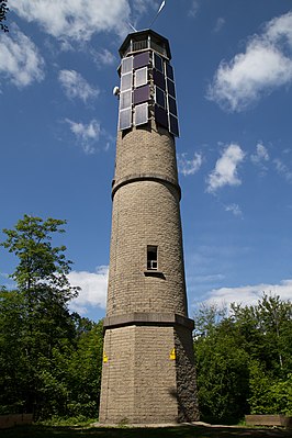
Brandeckkopf
| Brandeckkopf | ||
|---|---|---|
|
Fire tower |
||
| height | 685.8 m above sea level NHN | |
| location | Baden-Wuerttemberg , Germany | |
| Mountains | Middle Black Forest | |
| Coordinates | 48 ° 28 '2 " N , 8 ° 1' 35" E | |
|
|
||
| particularities | Fire tower ( AT ) | |
The Brandeckkopf is 685.8 m above sea level. NHN the highest mountain in Offenburg .
It is located in the Zell-Weierbach district . At its summit is the 23 m high Brandeckturm , a lookout tower built in 1895 from rammed concrete . The mountain is located within the 1,897-hectare nature sanctuary Brandeck .
Web links
Commons : Brandeckkopf - collection of images, videos and audio files

