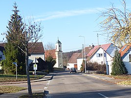
Breitenbach (Ellenberg)
|
Breitenbach
Community Ellenberg
Coordinates: 49 ° 2 ′ 7 ″ N , 10 ° 13 ′ 11 ″ E
|
|
|---|---|
| Height : | 473 m above sea level NHN |
| Residents : | 337 (Oct. 2019) |
| Postal code : | 73488 |
| Area code : | 07962 |
|
The Ellenberg district of Breitenbach
|
|
Breitenbach is one of 22 districts of the Baden-Württemberg community of Ellenberg , which is located in the Ostalb district .
geography
The hamlet is traversed by the Reichenbach . This creek is a left tributary of the Gerbaches and ends near the Dietlesmühle into this. Breitenbach is located at an altitude of 473 m above sea level. NN and is about two and a half kilometers from the southern Ellenberg.
history
Breitenbach was first mentioned in a document in 1284 under the name Praitenbuoch . At the end of the Holy Roman Empire , the village was owned by the prince provost of Ellwangen . With the secularization of the priesthood in 1802, Breitenbach was forcibly taken over by the Kingdom of Württemberg and then belonged to the newly created Oberamt Ellwangen . As a result of the administrative reforms carried out in the Kingdom of Württemberg at the beginning of the 19th century , the place became part of the independent rural community of Ellenberg, which also included 18 other villages.
traffic
The connection to the public road network is mainly established by a connecting road that, coming from the north-west of Matzenbach , continues in a south-easterly direction to the state road L 2220 .
Web links
- Map of Breitenbach on: State Institute for the Environment Baden-Württemberg (LUBW) ( Notes )
- Aerial photo of Breitenbach on: State Institute for the Environment Baden-Württemberg (LUBW) ( information )
Individual evidence
- ↑ Maps of the community of Ellenberg
- ^ Website of the municipality of Ellenberg , accessed on November 19, 2018
- ^ History of Breitenbach , accessed on November 19, 2018
- ↑ Composition of the rural community of Ellenberg , accessed on November 19, 2018

