
Britannia Range
| Britannia Range | ||
|---|---|---|
| Highest peak | Mount McClintock ( 3490 m ) | |
| location | Australian Antarctic Territory , East Antarctica | |
| part of | Transantarctic Mountains | |
|
||
| Coordinates | 80 ° 5 ′ S , 158 ° 0 ′ E | |

The Britannia Range is a mountain range in the Transantarctic Mountains . It is bounded to the north by the Hatherton Glacier and Darwin Glacier , to the south by the Byrd Glacier and to the west by the Ross Ice Shelf . It includes Mount McClintock , Dartmouth Peak and Mount Henderson .
The mountains were discovered in 1902 by the southern group of the Discovery Expedition (1901-1903) under the direction of the British polar explorer Robert Falcon Scott , who named them after the training ship HMS Britannia , on which numerous officers of the expedition had completed their cadet days.
Topographic map sheets
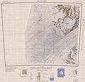
Western part

Eastern part


Web links
- Britannia Range in the Geographic Names Information System of the United States Geological Survey (English)
- Britannia Range on geographic.org (English)