Broken River (Bowen River)
| Broken River | ||
|
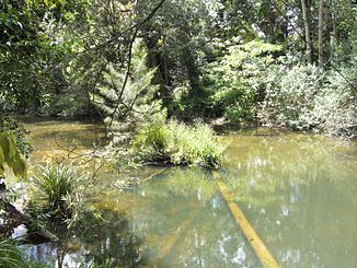
Broken River in Eungella National Park |
||
| Data | ||
| location | Queensland , Australia | |
| River system | Burdekin River | |
| Drain over | Bowen River → Burdekin River → Coral Sea | |
| source | at Palms Lookout, at the southern tip of Eungella National Park 21 ° 14 ′ 18 ″ S , 148 ° 32 ′ 25 ″ E |
|
| Source height | 793 m | |
| muzzle |
Bowen River at Tent Hill (Clark Range) Coordinates: 20 ° 59 ′ 58 " S , 148 ° 21 ′ 27" E 20 ° 59 ′ 58 " S , 148 ° 21 ′ 27" E |
|
| Mouth height | 148 m | |
| Height difference | 645 m | |
| Bottom slope | 6.2 ‰ | |
| length | 104 km | |
| Left tributaries | Spring Creek, Furios Creek, Black Gin Creek, Turn Back Creek, Alice Creek | |
| Right tributaries | Dry Creek, Bee Creek, Salitros Creek, Massey Creek, Urannah Creek, Grant Creek, Emu Creek | |
| Flowing lakes | Lake Eungella | |
| Communities | Palms Lookout, Catherine's Lookout | |
The Broken River is a river in the east of the Australian state of Queensland .
geography
River course
The river has its source at the Palms Lokkout settlement on the southern tip of the Eungella National Park , about 140 kilometers south-southeast of Bowen . From there it first flows west into Lake Eungella . It leaves this lake again at its north end and flows through the Broken River Range to the north-north-west and north-west. At Tent Hill it forms the Bowen River together with the Little Bowen River .
Tributaries with mouth heights
- Spring Creek - 582 m
- Dry Creek - 578 m
- Bee Creek - 391 m
- Furios Creek - 303 m
- Salitros Creek - 285 m
- Massey Creek - 268 m
- Urannah Creek - 241 m
- Black Gin Creek - 219 m
- Turn Back Creek - 210 m
- Grant Creek - 202 m
- Alice Creek - 178 m
- Emu Creek - 163 m
Flowing lakes
- Lake Eungella - 564 m
See also
Individual evidence
- ↑ a b c d e Map of Broken River, QLD . Bonzle.com
- ^ Steve Parish: Australian Touring Atlas . Steve Parish Publishing, Archerfield QLD 2007. ISBN 978-1-74193-232-4 . P. 10
