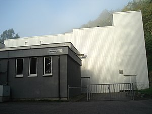
Bronnbachquelle
| Bronnbachquelle | |||
|---|---|---|---|
 The waterworks on the Bronnbach spring |
|||
| location | |||
| Country or region | District of Tübingen ( Baden-Württemberg ) | ||
| Coordinates | 48 ° 28 ′ 8 ″ N , 8 ° 54 ′ 18 ″ E | ||
|
|||
| geology | |||
| Mountains | Korngäu | ||
| Source type | Karst spring | ||
| Hydrology | |||
| River system | Rhine | ||
| Receiving waters | Bronnbach → Neckar → Rhine → North Sea | ||
| Bulk | 450 l / s | ||
Coordinates: 48 ° 28 ′ 8 ″ N , 8 ° 54 ′ 18 ″ E
The Bronnbachquelle is a strong karst spring near Rottenburg am Neckar in the Upper Gäu in Baden-Württemberg .
location
The Bronnbachquelle is located between the Obernau district and the core town of Rottenburg on the course of the Neckar . It is completely set and is located in the building of the municipal waterworks .
Data
The karst spring pours out an average of around 450 liters of water per second (max. 1180 l / s); its catchment area covers approx. 90 to 100 km². The part of the spring water that is not fed into the drinking water supply flows through a drainage pipe into the original course of the Bronnbach. This flows into the Neckar after a good 400 m in the left Neckar floodplain at the Bronnmühle . In addition to the Bronnbach spring, the paper mill well in the Neckarau also feeds into the water supply. Both sources now supply the city center, the Seebronn and Hailfingen districts as well as Weiler and Bad Niedernau south of the Neckar.
See also
Web links
Individual evidence
- ↑ Length of the Bronnbachlauf according to: Landesanstalt für Umwelt Baden-Württemberg (LUBW) ( information )
- ^ Official Journal of the City of Rottenburg am Neckar: Investigations by the Tübingen Regional Council

