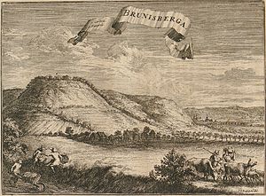
Brunsberg (Godelheim)
| Brunsberg | ||
|---|---|---|
| height | 300 m | |
| location | North Rhine-Westphalia , Germany | |
| Mountains | Weserbergland | |
| Coordinates | 51 ° 44 '40 " N , 9 ° 21' 52" E | |
|
|
||
The Brunsberg is a 300 m high elevation on the edge of the district Höxter - Godelheim and belongs to the Weserbergland . The remains of the Brunsburg are on the Brunsberg .
The Brunsberghütte standing on the Brunsberg was considered a refuge for hikers and those seeking relaxation. On May 4, 2006, the wooden hut was completely destroyed by fire. Later a new refuge was built in the same place. The top of the Brunsberg is the starting point for hang-gliders and paragliders, with the current landing site on Hechtgraben near the B 64 near Godelheim.
From the summit you have a clear view of the nearby villages of Boffzen , Beverungen , Holzminden and Fürstenberg as well as the Weser .
Individual evidence
- ^ Voluntary fire brigade Höxter: Brunsberghütte burned down


