Buckley Island
| Buckley Island | ||
|---|---|---|
|
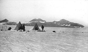
Buckley Island in December 1908 |
||
| height | 2645 m | |
| location | Ross Dependency , Antarctica | |
| Mountains | Transantarctic Mountains | |
| Coordinates | 84 ° 57 ′ 0 ″ S , 164 ° 0 ′ 0 ″ E | |
|
|
||
| Normal way | Alpine tour (glaciated) | |
The Buckley Island is a Nunatak in Antarctica , which in Transantarctic Mountains not far from the polar plateau from the Beardmore Glacier is circled. The highest point of the island-like massif, Mount Buckley , reaches a height of 2645 m. It was discovered by participants in the Nimrod expedition (1907–1909) led by the British polar explorer Ernest Shackleton (1874–1922). It is named after the New Zealand sheep farmer George Alexander McLean Buckley (1866–1937), one of the sponsors of the expedition.
Frank Wild (1873–1939) succeeded here on December 17, 1908 with the first detection of coal in the Antarctic by taking geological samples . On February 9, 1912, Edward Wilson (1872–1912) discovered plant fossils in the sandstone layers on Buckley Island as part of the Terra Nova Expedition .
See also
Web links
- Buckley Island in the Geographic Names Information System of the United States Geological Survey (English)
- Buckley Island on geographic.org (English)
Individual evidence
- ↑ Mount Buckley ( English ) In: Geographic Names Information System . United States Geological Survey . Retrieved October 26, 2013.
- ^ Ernest Shackleton, The Heart of the Antarctic Vol. I , William Heinemann, London 1909, pp. 326–327 (English, accessed from the Internet Archive on October 16, 2013).
- ^ Robert B. Stephenson: Antarctic Firsts. Information on antarctic-circle.org, July 12, 2011 (accessed October 16, 2013).
- ^ Leonard Huxley ( ed. ), Scott's Last Expedition, Vol. I , Smith, Elder & Co., London 1914, p. 565 (English, accessed from the Internet Archive on October 16, 2013).

