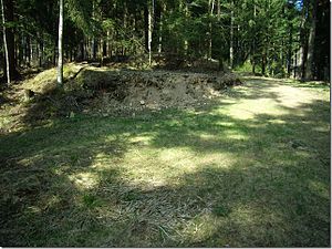
Erlach Castle Stables
| Erlach Castle | ||
|---|---|---|
|
Destruction of Burgstall Erlach by a "forest highway" |
||
| Creation time : | 1300 (worn out) | |
| Castle type : | Hilltop castle | |
| Conservation status: | Burgstall | |
| Place: | Neudorf district of the Haslach an der Mühl community | |
| Geographical location | 48 ° 33 '18.8 " N , 14 ° 2' 19.7" E | |
| Height: | 563 m | |
|
|
||
The Castle Erlach was in the town of Neudorf in Kreuzmayer wood on the left side of the valley of the Great Muehl in the town of Haslach in Rohrbach District (Farm Kreuzmayer, Neudorf no. 19).
The castle stables probably belonged to a chain of fortifications along the Große Mühl, which stretched over the Ganshübel castle stalls, which had been abandoned because of the construction of an electricity station, to the Schenberg Castle (Shenberg) and over Pürnstein , Blankenberg and Schallenberg Castle to the Danube . Presumably this was the old line of rule of the Blankenburgers. Erlach Castle has been abandoned since 1300.
Until recently, the Erlach Castle Stable was described as a facility on a spur protruding towards the Großer Mühl; the castle was cordoned off from the hinterland by four moats and ramparts. There is not much of that left today: The entire cultural area of the Burgstall was dredged away to make room for transport routes ("forest highways"). In the excavated material there are kilos of ceramic shards (so-called graphite ware).
literature
- Norbert Grabherr : The Burgstall ("The Purchstal"). In: Upper Austrian homeland sheets . 15th year, issue 2/3, Linz 1961, pp. 157–162 ( online (PDF; 938 kB) in the forum OoeGeschichte.at).
- Christian K. Steingruber : A critical consideration of the historical-topographical manual of the fortifications and mansions of Upper Austria . Upper Austrian Provincial Archives , Linz 2013.
Individual evidence
- ↑ DEHIO: Mühlviertel. 2003, p. 276.


