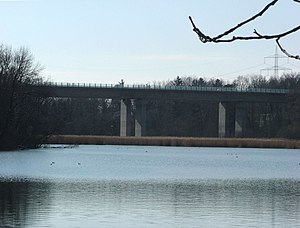
Buxachtal bridge
Coordinates: 47 ° 59 ′ 22 ″ N , 10 ° 8 ′ 10 ″ E
|
|
||
|---|---|---|
| View from the Buxheimer Weiher (2011) | ||
| use | Highway bridge | |
| Convicted | Federal motorway 96 | |
| Crossing of | Buxach Valley | |
| Subjugated | Buxach | |
| place | Buxheim | |
| construction | Box girder bridge | |
| overall length | 310.4 m | |
| Longest span | 46.8 m | |
| vehicles per day | 42471 (2010) | |
| building-costs | 7.8 million DM | |
| completion | 1990 | |
| Construction work | Josef Hebel GmbH & Co. KG | |
| location | ||
|
|
||
| Above sea level | 589 m above sea level NHN | |
The Buxachtalbrücke is a bridge structure on the federal motorway 96 . It spans the Upper Swabian Buxach Valley between Memmingen and Buxheim near the Buxheimer Weiher . It was designed as a box girder bridge and built using the incremental launching method . The structure was completely completed in 1990 as a motorway bridge. These are actually two individual bridges that were built independently of one another: After the first bridge with two lanes was opened in 1978, the second bridge with two more lanes was completed by 1990. Under the bridge is a wetland artificially created by the Carthusians of the former Buxheim Charterhouse .
description
The span of the two bridges is 46.8 meters, the length 310.4 meters and the area 3930 square meters. The deck girder has a superstructure width of 12.65 meters. The construction costs amounted to 7,800,000 DM . The client was the Federal Ministry of Transport as the representative of the Federal Republic of Germany. The autobahn directorate of Southern Bavaria and the Free State of Bavaria acted as clients. The construction was carried out by the Memmingen-based construction company Josef Hebel .
Web links
Individual evidence
- ↑ Supreme building authority in the Bavarian State Ministry of the Interior: Road traffic census 2010. In: baysis.bayern.de. 2010, accessed on April 3, 2016 (official figures).

