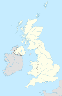
Caesaromagus (Chelmsford)
Coordinates: 51 ° 44 ' N , 0 ° 28' E
Caesaromagus was a Roman site in Britain . It was on what is now Chelmsford . The place is mentioned several times in ancient sources, for example in the Itinerarium Antonini (Iter V and IX) and by the geographer of Ravenna .
On the Tabula Peutingeriana , Baromaci is the first legible city name on the left edge of the map, of which the outer left sheet has been lost. This sheet probably described the western part of Britain and the Iberian Peninsula. It is believed that Baromaci is a corruption of Caesaromagus . The missing syllable Cae could have been found on the missing sheet, the first letter S on the damaged sheet opposite could have been mistakenly copied as B. The rendering of G with C as in maci is also common in copies.
Caesaromagus is about halfway between Londinium and Camulodunum ( Colchester ). The name probably goes back to a battlefield on which Emperor Claudius Caesar Augustus Germanicus fought a victorious battle before conquering Camulodunum in AD 43.
Caesaromagus does not seem to have had any direct Celtic predecessor settlement, although there are various older traces of settlement in the area of Chelmsford. The first Roman remains represent two little-studied military camps built one after the other, the first of which was founded around 65 AD. The second camp was abandoned around 80 AD and a civil settlement was established.
The core of the settlement was a large mansio (rest house), which had a large inner courtyard and its own bathing facility. Otherwise the development of the settlement was rather poor. Most of the structures found were made of wood. The road system was irregular. Only in the north could the foundations of an octagonal temple be excavated. The deity worshiped here is unknown. The building was built around 325 AD and was in operation until the fifth century, which can be proven by coin finds.
In the second century, the place received defenses in the form of a rampart (approx. 300 × 300 m) with a moat. Unlike in other places, these were not replaced by stone walls in the third century. Cemeteries came to light outside the wall during excavations.
The place was still inhabited in the fifth century, but was then abandoned.
The status of the place is controversial. It was assumed that it was the main town of the Civitas of the Trinovants , but there is no evidence of public buildings that characterize a Civitas capital.
Individual evidence
- ↑ Tabula Peutingeriana (illustration)
literature
- John Wacher: The Towns of Roman Britain , Routledge, London / New York 1997, 207-214 ISBN 0-415-17041-9

