
California State Route 79

|
|
|---|---|
| map | |

|
|
| Basic data | |
| Overall length: | 106.7 mi / 171.8 km |
| Starting point: |
|
| End point: |
|
| Counties: |
San Diego County Riverside County |
The California State Route 79 , abbreviated CA 79 is a state highway in the US state of California of nearly 172 kilometers in length. The State Route begins on Interstate 10 in Riverside and ends in San Diego County on Interstate 8 .
This State Route is part of the California Freeway and Express System and can be ordered for the State Scenic Highway System.
course
Route 79 begins near Beaumont on Interstate 10. Near Julian , CA 79 passes California State Route 78 . The next major town the State Route passes through is Murrieta and Temecula . The CA 79 then leads over a range of hills ( Lambs Canyon ) to San Jacinto and Hemet . Then, it ends in Descanso .

California State Route 79

California State Route 79 and Lake Cuyamaca
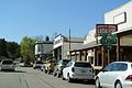
California State Route 78 and 79 in Julian


See also
Web links
- AARoads: California 79 (English)
- California Highways: State Route 79 (English)