
Camí de Cavalls
Coordinates: 39 ° 53 ′ 51.1 ″ N , 4 ° 15 ′ 26.8 ″ E

The GR 223 - Camí de Cavalls ( Catalan for "path for horses") is a long-distance hiking trail on the island of Menorca , Spain . It is 185 km long and part of the GR long-distance hiking network .
history
The Camí de Cavalls probably took shape as early as the 14th century and was originally used by the "Caballeries" (landowners with a feudal background) to develop the coast around the island. The Camí was first mentioned in writing in the 17th century as a path that completely circled the island of Menorca. Until the 20th century, the path was mainly used by the military with horses for defense purposes, but it was also available to the common people. From the 20th century, private properties were built on individual sections and the Camí de Cavalls could not be used for a long time. In the 1980s, Menorcians began campaigning for the horse trail to be reopened.
Camí de Cavalls today
The Camí de Cavalls still runs partly over private property, but has been freely accessible again since the mid-2000s. On many of the stages there is no possibility to buy water, and overnight accommodations are difficult to find on the entire hiking trail. A complete inspection without leaving the route is therefore almost impossible. The Camí de Cavalls should be planned and developed in individual stages.
Stages
![]() Map with all coordinates: OSM | WikiMap
Map with all coordinates: OSM | WikiMap
|

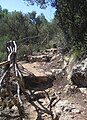
Pictures of the route sections

Section 7 (Ets Alcos)

Section 11 (Ciutadella)
Section 12 (Punta d'Artrutx)

Section 12 (towards Cala en Turqueta)

Section 16 (Llucalari)


.jpg)
GR 1 | GR 2 | GR 3 | GR 4 | GR 4.1 | GR 4.2 | GR 5 | GR 6 | GR 7 | GR 7.1 | GR 7.2 | GR 7.3 | GR 7.4 | GR 8 | GR 8.1 | GR 8.2 | GR 9 | GR 10 | GR 10.1 | GR 10.2 | GR 11 | GR 11.1 | GR 12 | GR 12.1 | GR 12.3 | GR 13 | GR 14 | GR 15 | GR 16 | GR 17 | GR 18 | GR 18.1 | GR 19 | GR 20 | GR 21 | GR 22 | GR 23 | GR 24 | GR 25 | GR 26 | GR 27 | GR 28 | GR 29 | GR 30 | GR 33 | GR 34 | GR 36 | GR 37 | GR 38 | GR 39 | GR 40 | GR 41 | GR 42 | GR 43 | GR 45 | GR 47 | GR 48 | GR 50 | GR 52 | GR 53 | GR 56 | GR 59 | GR 60 | GR 63 | GR 65 | GR 65.3 | GR 65.5 | GR 66 | GR 67 | GR 68 | GR 69 | GR 71 | GR 72 | GR 73 | GR 74 | GR 75 | GR 82 | GR 83 | GR 84 | GR 85 | GR 86 | GR 88 | GR 89 | GR 90 | GR 90.1 | GR 92 | GR 92.1 | GR 92.2 | GR 92.3 | GR 93 | GR 93.1 | GR 94 | GR 95 | GR 96 | GR 97 | GR 98 | GR 98.1 | GR 99 | GR 100 | GR 101 | GR 105 | GR 106 | GR 107 | GR 108 | GR 120 | GR 121 | GR 123 | GR 124 | GR 127 | GR 132 | GR 150 | GR 170 | GR 171 | GR 172 | GR 173 | GR 174 | GR 175 | GR 176 | GR 177 | GR 178 | GR 179 | GR 192 | GR 210 | GR 211 | GR 221 | GR 222 | GR 229 | GR 236 | GR 241 | GR 242 | GR 249