Caniço
| Caniço | ||||||
|---|---|---|---|---|---|---|
|
||||||
| Basic data | ||||||
| Autonomous Region : | Madeira | |||||
| Concelho : | Santa Cruz | |||||
| Coordinates : | 32 ° 38 ′ N , 16 ° 51 ′ W | |||||
| Residents: | 23,368 (as of June 30, 2011) | |||||
| Surface: | 11.99 km² (as of January 1, 2010) | |||||
| Population density : | 1949 inhabitants per km² | |||||
| Height: | 230 m | |||||
| Postal code : | 9125-067 | |||||
| politics | ||||||
| Mayor : | José Aníbal Rodrigues Alves ( PSD ) | |||||
| Address of the municipal administration: | Junta de Freguesia de Caniço Estrada Garajau 5 9125-067 Caniço |
|||||
| Website: | www.jf-canico.pt | |||||
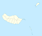
Caniço is with 23,368 inhabitants (as of June 30, 2011) the fastest growing municipality in Madeira and belongs to the Santa Cruz district . The community, which is widely scattered in several districts and separate settlements, is located on the east coast of the island at an altitude of 0 to 400 meters (main town 230 meters), around eight kilometers east of the island's capital Funchal .
History of the place

Until the late 1960s, the place was a hillside village with numerous small scattered individual farmsteads and a tiny fishing port, which had around 1200 inhabitants. Many of the farmer's children had to migrate to the mainland out of poverty or to South America - primarily Venezuela.
From 1967 onwards, investors discovered the 30–40 meter high cliff for tourist settlements and began to settle on plots near the coast in the “Contracta Urbanization”. In the new suburb of Caniço de Baixo , mostly German holiday home buyers initially settled as residents and long-term tourists in around 120 bungalows, villas and three apartment houses. Soon there was a working rock pool with a restaurant and a shop, and a little later the development of smaller hotels began. After the opening of the extended runway at Madeira Airport (September 2000), which is only nine kilometers to the east, a new wave of investments by international groups began in larger hotel complexes towards the flatter coast in the east. Now, wide-bodied aircraft from overseas can also reach the island and make better use of the large hotels.
The good public infrastructure created in the course of the tourist expansion from 1995 (expressway connection, road network expansion, hillside developments) and the job offer in the service sector have increasingly attracted younger people from Funchal and the island's interior. Even numerous returnees from Venezuela and Brazil can be found among the new citizens. Madeira, which is supported by the EU and mainland, can now offer them more opportunities than the South American emigration areas. The new residents live primarily in apartment buildings and private homes in z. Partly exposed slopes that are grouped like a wreath around the village center.
Caniço has twelve medium and large hotels and some smaller landlords with a total of around 3000 beds. Together with Garajau immediately to the west , it forms the second largest tourist location on the island after Funchal.
The previously flourishing, but very small-scale agriculture (cultivation of onions, bananas and sugar cane , individual cow husbandry in the shed, fish husbandry in the fresh water basin at the house) has practically disappeared, except for self-consumption cultivation .
sons and daughters of the town
- José Alfredo Caires de Nobrega (* 1951), bishop in the Diocese of Mananjary in Madagascar
Web links
Individual evidence
- ↑ www.ine.pt - indicator resident population by place of residence and sex; Decennial in the database of the Instituto Nacional de Estatística
- ↑ Overview of code assignments from Freguesias on epp.eurostat.ec.europa.eu


