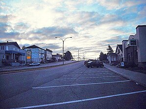
Chapais
| Chapais | ||
|---|---|---|
 Chapais |
||
| Location in Quebec | ||
|
|
||
| State : |
|
|
| Province : | Quebec | |
| Administrative region : | North du Quebec | |
| MRC or equivalent : | Jamésie | |
| Coordinates : | 49 ° 47 ′ N , 74 ° 51 ′ W | |
| Area : | 63.64 km² | |
| Residents : | 1630 (as of 2006) | |
| Population density : | 25.6 inhabitants / km² | |
| Time zone : | Eastern Time ( UTC − 5 ) | |
| Municipality number: | 99020 | |
| Postal code : | GOW | |
| Mayor : | Steve Gamache | |
| Website : | www.villedechapais.com | |
Chapais is a city ( Ville ) in the north of the Canadian province of Québec .
The small town is located in the Jamésie in the south of the administrative region of North du Québec . It was founded in 1929 after natural resources were discovered in the area. The city is named after the politician Thomas Chapais (1858–1946), son of Jean-Charles Chapais . In 2006 Chapais had 1630 inhabitants.
In terms of traffic, the city is connected to the highway network of the province of Québec via Route 113 . This connects Chapais with Chibougamau to the east and Senneterre to the west . The airport Aéroport de Chibougamau-Chapais is about 40 km to the east .
Web links
Commons : Chapais - collection of images, videos and audio files
