Chełm (rural municipality)
| Gmina Chełm | ||
|---|---|---|

|
|
|
| Basic data | ||
| State : | Poland | |
| Voivodeship : | Lublin | |
| Powiat : | Chełmski | |
| Geographic location : | 51 ° 6 ' N , 23 ° 27' E | |
| Height : | 217 m npm | |
| Residents : | see Gmina | |
| Gmina | ||
| Gminatype: | Rural community | |
| Surface: | 221.82 km² | |
| Residents: | 14,866 (Jun. 30, 2019) |
|
| Population density : | 67 inhabitants / km² | |
| Community number ( GUS ): | 0603032 | |
| administration | ||
| Wójt : | Wiesław Kociuba | |
| Address: | Pokrówka, ul.Gminna 18 22-100 Chełm |
|
| Website : | www.gmina.chelm.pl | |
The gmina wiejska Chełm is an independent rural municipality in Poland in the Powiat Chełmski in the Lublin Voivodeship . Its seat is not in the city of Chełm , but in Pokrówka, which has a population of 1,600 . The independent city of Chełm forms its own municipality.
geography
Geographical location
The rural community (Gmina) includes areas bordering the city of Chełm in the north, west and south and is roughly in the middle of the Chełmski Powiat.
history
In the course of the Third Partition of Poland , the region came under the Habsburg Monarchy in 1795 . In 1809 it became part of the Duchy of Warsaw installed by Napoleon and in 1815 part of the Congress Poland , which was part of the Tsarist Empire . On August 15, 1863, a battle of the January Uprising took place in Depułtycze Królewskie , which ended victorious for Poland. 11 insurgents and 23 Russians were killed.
In 1919 the area became part of the Second Polish Republic and during the Second World War it was occupied by the Wehrmacht from 1939 to 1944 .
Administrative history
The rural community of Chełm was formed in 1973 from the two rural communities Gmina Krzywiczki and Gmina Staw . Their seats were on the one hand in the 19th century and until 1945 in Krzywiczki ( (location) ), then until 1954 in Pokrówka and on the other hand in the village of Staw (540 inhabitants (2011) , (location) ). From 1975 to 1998 the rural community belonged to the Chełm Voivodeship .
Community structure
|
|
Culture and sights
Buildings
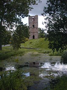
- Castle (13th century) in Stołpie
- Wooden church in Nowe Depułtycze
- Church in Podgórze
- Castle (17th / 18th century) and park in Srebrzyszcze
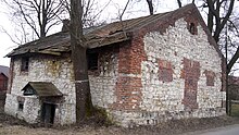
- Mill in Uher
- Mill in Weremowice
- Watermill in Zawadówka
Culture
- Ośrodek Kultury Gminy Chełm , Gmina Cultural Center in Żółtańce
Nature reserves
- Rezerwat przyrody Stawska Góra
- Rezerwat przyrody Brzeźno ( Moor )
- Rezerwat przyrody Bagno Serebryskie (Moor)
- Rezerwat przyrody Torfowisko Sobowice (Moor)
traffic
- Airfield ( special landing site ): Lądowisko Chełm-Depułtycze Królewskie ( ICAO code : EPCD) with a 720 m grass runway in Depułtycze Królewskie.
Web links
Individual evidence
- ↑ population. Size and Structure by Territorial Division. As of June 30, 2019. Główny Urząd Statystyczny (GUS) (PDF files; 0.99 MiB), accessed December 24, 2019 .
- ^ Stefan Kieniewicz: Powstanie styczniowe . Warszawa, 1983. ISBN 83-01-03652-4
- ↑ http://www.cholmerland.de/Siedlungen
- ↑ EPCD airfield (Polish, English)


