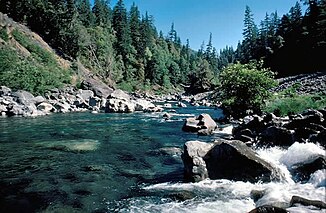
Chetco River
| Chetco River | ||
|
The drainage basin and course of the Chetco River |
||
| Data | ||
| Water code | US : 1139619 | |
| location | Curry County in Oregon (USA) | |
| Headwaters |
Kalmiopsis Wilderness Area 42 ° 7 ′ 47 ″ N , 123 ° 52 ′ 39 ″ W |
|
| Source height | approx. 975 m | |
| muzzle | at Brookings in the Pacific Coordinates: 42 ° 2 ′ 43 " N , 124 ° 16 ′ 14" W 42 ° 2 ′ 43 " N , 124 ° 16 ′ 14" W |
|
| Mouth height | 0 m | |
| Height difference | approx. 975 m | |
| Bottom slope | approx. 11 ‰ | |
| length | 88 km | |
| Catchment area | 914 km² | |
| Discharge at the gauge near Brookings A Eo : 702 km² Location: 17 km above the mouth |
NNQ (Oct 14, 1987) MQ 1970/2016 Mq 1970/2016 HHQ (Dec 22, 1964) |
1.2 m³ / s 63 m³ / s 89.7 l / (s km²) 2420 m³ / s |
| Left tributaries | South Fork Chetco River | |
| Right tributaries | North Fork Chetco River | |
| Small towns | Brookings | |
| Communities | Harbor | |
| National Wild and Scenic River | ||
|
Chetco River near Boulder Creek |
||
|
Chetco River at Harbor just before its mouth |
||
The Chetco River is a 88 km long river in Curry County in the extreme southwest of the US state Oregon .
The Chetco River has its source in the Kalmiopsis Wilderness Area at an altitude of approximately 975 m . It flows in a left curve initially to the north and later to the west. It eventually flows into the Pacific Ocean . The small town of Brookings is north of the estuary, the town of Harbor south. The US Highway 101 crosses the river a kilometer from the mouth. The Chetco River drains a largely forested mountainous region on the west coast of Oregon. The catchment area covers 914 km².
The river is home to salmonids such as steelhead trout (winter), king salmon (autumn) and cutthroat trout . The main fishing season is between November and March.
Furthermore, the river can be explored with a white water kayak in the winter months .
In 1988, the stretch of river between river kilometers 16 and 88 was classified as a National Wild and Scenic River .
Individual evidence
- ^ Chetco River in the Geographic Names Information System of the United States Geological Survey
- ^ A b c Scientific Investigations Report 2010–5065: Channel Change and Bed-Material Transport in the Lower Chetco River, Oregon . USGS. Retrieved September 2, 2017.
- ↑ USGS 14400000 CHETCO RIVER NEAR BROOKINGS, OR
- ↑ a b c d National Wild and Scenic Rivers System: Chetco River, Oregon


