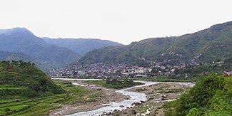
Chico (river)
| Chico | ||
|
The Chico at Bontoc |
||
| Data | ||
| location | Luzon , Philippines | |
| River system | Cagayan | |
| Drain over | Cagayan → Pacific Ocean | |
| origin | Confluence of two source rivers 17 ° 0 ′ 30 ″ N , 120 ° 55 ′ 37 ″ E |
|
| muzzle | in the Gattaran area in the Cagayan coordinates: 17 ° 57 ′ 53 " N , 121 ° 36 ′ 43" E, 17 ° 57 ′ 53 " N , 121 ° 36 ′ 43" E
|
|
| Medium-sized cities | Bontoc , Tabuk City | |
The Chico is a river in the north of the Philippine island of Luzon .
The full name is Rio Chico de Cagayan ("Little Cagayan"). It rises in the province of Benguet , about 14 km north of Kabayan . The headwaters are on Mt. Data in the Philippine Cordilleras . The rivers Agno and Abra also have their source just a few kilometers away .
The Chico flows north first. The Lepanto and Bontoc tribes settle here. It passes Bontoc , Bituagan, Tinglayan and Tabuk in Kalinga Province . At Nabbayugan and Macical, the river is dammed into two reservoirs. It flows into the Cagayan at Caggag and Nassiping (city of Gattaran ) . The Christian Itavi (also called Ytabes or Tawish) live on the lower Chico and grow tobacco, rice and maize.
Important tributaries are the Tanudan, the Saltan from the west, the Mabaca, the Bananid and the Matalag.
White water kayak tours are available on the river.
Individual evidence
- ^ Félix Maxwell Keesing: The ethnohistory of northern Luzon. Stanford University Press 1962, p. 221 Google Book Search
