Chinandega (city)
| Chinandega | ||
|---|---|---|
|
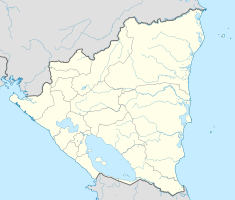
Coordinates: 12 ° 37 ′ N , 87 ° 8 ′ W Chinandega on the map of Nicaragua
|
||
| Basic data | ||
| Country |
|
|
| Department | Chinandega | |
| City foundation | 596 (presumed) 1839 sp. Start-up |
|
| Residents | 133,700 (2004) | |
| City insignia | ||
| Detailed data | ||
| height | 50 m | |
| Waters | Pacific | |
| Time zone | UTC −6 | |
Chinandega is a city in the Chinandega department of the same name in the northwest of the Central American state of Nicaragua with approx. 133,700 inhabitants (2004). It is located 134 km northwest of Managua , the capital of Nicaragua, and lies on the Pacific coast .
The favorable climate and the fertile soils allow the cultivation of oranges , sugar cane , bananas and cotton . Chinandega has an average temperature of 28 ° C. The rainy season lasts from May to October, after which the dry season begins.
history
Chinandega was probably founded as early as 596 . Before the discovery of America by the Spaniards, Chinandega was a large area and was called "Tezoatega". Today's name means something like "place of the palm roofs" in the Nahuatl language. From 1529 - during the Spanish colonial era - the place was the seat of a patron and developed into a center of agriculture. At that time Chinandega took on the rank of a "villa", ie a smaller town. In 1839 Chinandega was made a city by decree. During the civil war in 1927, a large part of the city burned down, which earned it the nickname "Martyr City".
In 1989, on the occasion of its 150th anniversary, it was declared a “Nicaraguan cultural asset”.
Town twinning
Chinandega has four town twinning partnerships worldwide
-
 Leverkusen , Germany since 1986
 -
 Eindhoven , Netherlands since 1986
 -
 Molins de Rei , Spain since 1985
 -
 Appleton (Wisconsin) , USA since 1995


