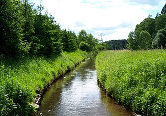
Chotla
|
Chotla Kautel |
||
| Data | ||
| location | Powiat Koszaliński and Białogardzki , West Pomeranian Voivodeship , Poland | |
| River system | Parsęta | |
| Drain over | Radew → Parsęta → Baltic Sea | |
| source | in Wojęcino | |
| muzzle | at Buczek in the Radew coordinates: 54 ° 3 '23 " N , 16 ° 7' 52" E 54 ° 3 '23 " N , 16 ° 7' 52" E
|
|
| length | 26 km | |
The Chotla (German Kautel ) is a small river in Poland that flows south-north in the eastern powiat Białogardzki (Belgard district) in the West Pomeranian Voivodeship .
The Chotla rises quite inconspicuously in the district Wojęcino (Wojenthin) in the south-western area of the Powiat Koszaliński (Köslin district) .
On its path that initially leads west and then swings in a large arc in a northerly direction, the 26-kilometer-long river passes the towns of Wełdkówko (Klein Voldekow) , Pobądz (Pobanz) , Bukowo (Alt Buckow) , Retowo (Rottow) , Bukówko (Neu Buckow) , Słonino (Schlennin) and Zaspy Małe (Klein Satspe).
In the northern district of Buczek (Butzke) the Chotla finally flows into the Radew (Radüe).
On its way, the Chotla drove numerous water mills . Today the section from Pobądz is a popular stretch for canoeing .
At Bukowo the Chotla and the Hasselbach, which flows south of it, approach each other by less than 200 meters. On the night of July 16 to 17, 1888, the Hasselbach swelled so much after a hurricane-like storm that it broke through over a distance of 20 meters and poured its water into the Kautel, turning the whole area into a dangerously large lake. The subsequent securing did not prevent the stream from overflowing its banks several times and its water flowing into the Chotla.
literature
- The Kautel - a brook valley . In: Home district committee Belgard-Schivelbein (ed.): The district of Belgard. From the story of a Pomeranian home district . Celle, 1989, pp. 57-60.
