Cima Monticello
| Cima Monticello | ||
|---|---|---|
|
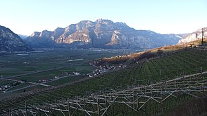
View from Giovo over the Rotaliana plain to Cima Monticello |
||
| height | 1857 m slm | |
| location | Trentino , Italy | |
| Mountains | Alps , Mendelkamm , Nonsberg Group | |
| Dominance | 1.5 km → Wiggerspitze | |
| Notch height | 90 m | |
| Coordinates | 46 ° 14 '59 " N , 11 ° 7' 19" E | |
|
|
||
The Cima Monticello is a 1857 m slm high mountain in the Mendelkamm , part of the Nonsberg group in the Alps .
Location and surroundings
The Cima Monticello is one of the last prominent elevations of the southern Mendel ridge before it runs out to the Rotaliana plain . This ridge connects the Cima Monticello with neighboring peaks, for example the Wiggerspitze ( Cima Roccapiana , 1873 m ) in the northeast and the Bodrina ( 1671 m ) in the southwest. The top of the mountain also marks the border between the municipalities of Ton and Mezzocorona in Trentino .
Climbs
The summit of the Cima Monticello cannot be reached directly via marked hiking trails, but it can still be climbed easily. To do this, hike from Roverè della Luna , Ton or Mezzocorona to path no.504 on the ridge and follow it until you see the highest point and then climb - albeit without a path.
swell
- Compass , Val di Non - Non Valley , sheet 95, 1: 50,000

