Citânia de Santa Luzia
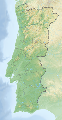
Location of the Citânia de Santa Luzia in Portugal. |
The Citânia de Santa Luzia , also known as Cidade Velha de Santa Luzia , is an Iron Age- Roman hill settlement of the Castro culture in northwestern Portugal .
location
The settlement is located on the top of the 250 m high, eponymous mountain Monte de Santa Luzia immediately north of Viana do Castelo in the district of the same name .
Naturally protected by comparatively steep slopes, the Citânia is in a geographically strategic position that allows control of the mouth of the Rio Lima into the Atlantic , the neighboring Atlantic coast and the surrounding lands.
history
The findings and findings excavated so far allow the settlement to be dated with a focus on the period from the 1st century BC. Until the 1st century AD. A coin find by Gallienus makes it likely that the area will continue to be used until the 3rd century AD.
Although smaller than the well-known settlements of Briteiros and Sanfins , the Citânia de Santa Luzia is a remarkable example of the fortified settlements of this period in the northwest of the Iberian Peninsula, both in terms of town planning, the typology of the house floor plans and their defensive character.
research
The Castro was first mentioned in the 17th century, but it was not until 1876 that the first excavations took place on the initiative of J. Possidonio da Silva. So far only a third of the former settlement area has been uncovered. The construction of a hotel and the church Santuario de Santa Luzia in the 19th century irrevocably destroyed part of the settlement.
The settlement area is now registered and protected as a Monumento Nacional. The excavation has been open to the public (again) since 1994 and a “Centro Interpretativo” has been added.
Findings
The character of the settlement, which is already clearly fortified by its location, is reinforced by three approximately concentric wall rings with two trenches in between. The walls are 1.8–2 meters thick and are additionally reinforced on the inside. An access ramp and stairs, one of which is still nine steps high, provide access to the top of the wall. The highest point of the mountain was raised and provided with a strong wall. This area remained free of residential development and possibly served as the “citadel” of the settlement.
The interior of the Citânia is characterized by the separation of the individual residential structures into "farmsteads". Several buildings are combined into units by walls or the partly paved streets and separated from the neighboring buildings.
Three types of floor plans can be distinguished within the 74 buildings known to date: approximately circular with a diameter of up to 3.3 m, elliptical and more rarely rectangular floor plans with a length of up to 6.5 m. Some of the buildings are supplemented by an anteroom. The entrances to the buildings are mostly oriented towards the southeast and follow the slope downwards to protect the interior from rainwater and the northeast winds.
In the middle of the round building a small stone (approx. 20 × 25 cm) can be seen several times. It is unclear whether this is the remains of a fireplace or the trailer for a post that supports the (conical) roof.
Finds
In addition to pre-Roman ceramics, most of the finds date from Roman times. Remnants of amphorae, Roman bricks, a bronze brooch and a bronze needle with a circular ornament on the head. In addition to the coin of Gallienus already mentioned, a small bronze altar (arula) and the upper part of a granite altar from Roman times should be mentioned here.
The majority of the finds are now kept in the two Lisbon museums, Museu Nacional de Arqueologia and Museu do Instituto Geológico e Mineiro.
literature
- Thomas G. Schattner (ed.): Archaeological guide through Portugal (= cultural history of the ancient world . Volume 74). Philipp von Zabern, Mainz 1998, ISBN 3-8053-2313-1 , p. 59.
- J. Leite de Vasconcelos: Cidade velha de Santa Luzia. In: O Arqueólogo Português. Volume VIII, 1903, p. 15 ff.
- further reading under Patrimonio Cultural sv Bibliografia.
Individual evidence
- ↑ a b Thomas G. Schattner (ed.): Archaeological guide through Portugal (= cultural history of the ancient world. Vol. 74). Philipp von Zabern, Mainz 1998, p. 59.
- ↑ a b c d e J. Leite de Vasconcelos: Cidade velha de Santa Luzia. In: O Arqueólogo Português. Volume VIII, 1903, p. 15 ff.
- ^ A b Portal do Arqueólogo. Retrieved October 1, 2017 .
- ↑ a b DGPC | Pesquisa Geral. Retrieved October 1, 2017 (Portuguese).
Web links
Coordinates: 41 ° 42 ′ 18 ″ N , 8 ° 50 ′ 6 ″ W.


