Colorado City (Arizona)
| Colorado City | |
|---|---|
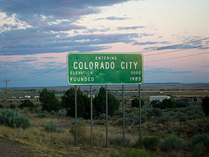
 Entrance to Colorado City |
|
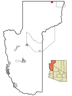
| Location in County and Arizona | |
| Basic data | |
| Foundation : | 1913 |
| State : | United States |
| State : | Arizona |
| County : | Mohave County |
| Coordinates : | 36 ° 59 ′ N , 112 ° 58 ′ W |
| Time zone : | Mountain Standard Time ( UTC − 7 ) |
| Residents : | 4,607 (as of 2006) |
| Population density : | 169.4 inhabitants per km 2 |
| Area : | 27.2 km 2 (approx. 11 mi 2 ) of which 27.2 km 2 (approx. 11 mi 2 ) is land |
| Height : | 224 m |
| Postal code : | 86021 |
| Area code : | +1 928 |
| FIPS : | 04-14870 |
| GNIS ID : | 0003123 |
Colorado City is a place in Mohave County in the northwest of the US state Arizona , the so-called Arizona Strip . Although the city has the name City in its name, it is a town . There live 3334 people on an area of 27.2 km². The population density is 122.5 inhabitants / km². The settlement borders Hildale , Utah in the north , together both are referred to as Short Creek after the stream through both villages . Colorado City is served by Arizona State Route 389 to the east on US Highway 89A and by Utah State Route 59 to the northwest towards Hurricane .
The site was founded in 1913 by supporters of the Fundamentalist Church of Jesus Christ of Latter-day Saints , an offshoot of the Church of Jesus Christ of Latter-day Saints ("Mormons"), and is still a focus of settlement for church members today.
In the US census for 2010, Colorado City was identified as the “youngest city” in the US with a mean age of 12.6 years.
traffic
Colorado City Municipal Airport is located in the village . Arizona State Route 389 runs through Colorado City .
Web links
Individual evidence
- ↑ Bloomberg news: Polygamist Haven, Graying Maine Mark US Aging Extremes , May 26, 2011
