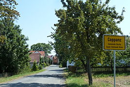
Coppanz
|
Coppanz
Bucha municipality
Coordinates: 50 ° 53 ′ 59 ″ N , 11 ° 31 ′ 46 ″ E
|
|
|---|---|
| Height : | 405 m |
| Incorporation : | 17th September 1961 |
| Postal code : | 07751 |
| Area code : | 03641 |
|
Entrance
|
|
Coppanz is a part of the municipality of Bucha in the Saale-Holzland district in Thuringia .
geography
Coppanz is located to the west of the Jena - Ammerbach district a little below the Coppanzer Berg on a high plateau that merges further west into the arable plains before Weimar . The floors are made of weathered shell limestone . To the east, i.e. to Jena, and also partly on the slopes of the Saale valley, there is forest. The main road in 2308 connects the district via a link road with Bucharest and Jena.
history
It was first mentioned in a document in 1236. Originally, the village belonged to the fiefdom of the Burgraves of Kirchberg . In the Saxon fratricidal war (1446-1451) the place was destroyed and then lay desolate. It was not until 1723 that the site was repopulated by citizens of Ammerbach. The village church of Coppanz was built in 1812 .
Web links
Individual evidence
- ^ Otto Dobencker : Regesta diplomatica necnon epistolaria historiae Thuringiae. Volume 3: (1228-1266). G. Fischer, Jena 1925, no.640.
- ↑ Coppanz on the website of the Evangelical Lutheran Church District Jena Query on December 31, 2016

