Cordillera Huaytapallana
| Cordillera Huaytapallana | ||
|---|---|---|
|
Glacier on the southern flank of Nevado Yanaucsha |
||
| Highest peak | Nevado Huaytapallana ( 5557 m ) | |
| location | Region Junín ( Peru )
|
|
| part of | Peruvian Central Cordillera | |
|
|
||
| Coordinates | 11 ° 55 ′ S , 75 ° 3 ′ W | |
The Cordillera Huaytapallana is a mountain range in the Peruvian Central Cordillera of the Andes .
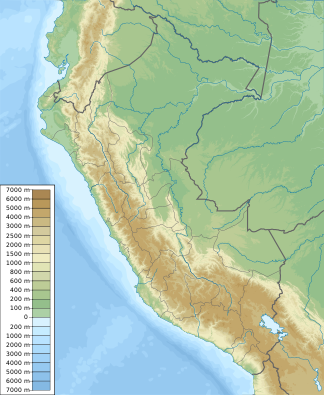
The Cordillera Huaytapallana is located in central Peru in the provinces of Huancayo and Concepción in the Junín region , 25 km northeast of the regional capital Huancayo .
The partly glaciated mountain range runs about 22 km in a north-westerly direction. At the end of the 20th century, the glacier area was 35 km². The highest point is the 5557 m high Nevado Huaytapallana . The mountain range is drained to the west to the upper reaches of the Río Mantaro , to the north to the Río Tulumayo and to the east via the Río Pariahuanca to the lower reaches of the Río Mantaro.
Summit (selection)
- Nevado Huaytapallana (5557 m, ⊙ )
- Nevado Yanaucsha (5530 m, ⊙ )
- Nevado Chuspi (5346 m, ⊙ )
- Nevado Cochas (5315 m, ⊙ )
- Nevado Putcacocha (5236 m, ⊙ )
- Nevado Talves (5257 m, ⊙ )
- Nevado Anchigrande (5350 m, ⊙ )
- Nevado Muratayu (5245 m, ⊙ )
- Nevado Pacaco (5200 m, ⊙ )
- Nevado Puihuan (5100 m, ⊙ )
- Nevado Tello (5050 m, ⊙ )
- Nevado Panchamaco (5012 m, ⊙ )
- Nevado Marairazo (4943 m, ⊙ )
Mountain lakes (selection)
- Laguna Cocha Grande (Laguna Jatuccocha) (4597 m, ⊙ )
- Laguna Yanaucsha (4775 m, ⊙ )
- Laguna Carhuacocha (4412 m, ⊙ )
- Laguna Chuspicocha (4636 m, ⊙ )
- Laguna Pumacocha (4622 m, ⊙ )
- Laguna Lasuntay (4646 m, ⊙ )
- Laguna Acapuachanan (4707 m, ⊙ )
![]() Map with all coordinates: OSM | WikiMap
Map with all coordinates: OSM | WikiMap
Web links
- Cordillera Central at USGS

