Cronenwett Island
| Cronenwett Island | ||
|---|---|---|
| Waters | Southern ocean | |
| Archipelago | Marshall Archipelago | |
| Geographical location | 77 ° 0 ′ S , 150 ° 0 ′ W | |
|
|
||
| length | 32 km | |
| width | 26 km | |
| surface | 640 km² | |
| Highest elevation | 432 m | |
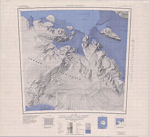
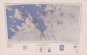
The Cronenwett Island (or also Cronenwett Island ) is a towering, ice-covered and about 32 kilometers long island , which is embedded in the Marshall Archipelago in the Sulzberger Ice Shelf off the Saunders coast of Marie Byrd Land between Vollmer Island and the Steventon Island is located.
It was discovered and roughly mapped on the basis of aerial photographs during the first Antarctic expedition (1928–1930) of the American polar explorer Richard Evelyn Byrd . The Advisory Committee on Antarctic Names named them after Commander Wilson Robertson Cronenwett (1913-1994), participant in Operation Deep Freeze 1956-1957 and 1962.
cards
Web links
- Cronenwett Island in the Geographic Names Information System of the United States Geological Survey (English)
- Cronenwett Island on geographic.org (English)
Individual evidence
- ^ John Stewart: Antarctica - An Encyclopedia . Vol. 1, McFarland & Co., Jefferson and London 2011, ISBN 978-0-7864-3590-6 , p. 372 (English).


