Crowsnest Pass
| Crowsnest Pass | |||
|---|---|---|---|
|
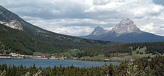
Crowsnest Pass Region with Crowsnest Mountain |
|||
| Compass direction | west | east | |
| Pass height | 1356 m | ||
| province | British Columbia ( Canada ) | Alberta | |
| Watershed | Elk River → Kootenay River → Columbia River | Crowsnest River → Oldman River → South Saskatchewan River → Saskatchewan River → Nelson River | |
| Valley locations | natal | Coleman | |
| expansion | Crowsnest Highway , Canadian Pacific Railway | ||
| Mountains | Crowsnest Ridge ( Canadian Rockies ) | ||
| map | |||
|
|
|||
| Coordinates | 49 ° 37 '53 " N , 114 ° 41' 33" W | ||
The Crowsnest Pass ( Eng. "Crow's Nest Pass") is the southernmost mountain pass in the Canadian Rocky Mountains on the border between the provinces of British Columbia and Alberta , not far from the border with the USA . The 1356 m high pass is named after Crowsnest Mountain , which got its name from the Cree Indians living in the area . In 1898 a branch of the Canadian Pacific Railway was built over the pass to develop the rich coal deposits . Today, in addition to the railway line, the Crowsnest Highway ( British Columbia Highway 3 and Alberta Highway 3 ) and an oil pipeline run over the pass.
The pass lies on the continental divide .
history
The passport was known to the First Nations resident here for a long time and was used by them. He was long unknown to white settlers and explorers. Before 1860 it was not on any map. The first white user is Thomas Blakiston, who originally belonged to John Palliser's British North American Exploring Expedition . In his travel diary he documented the pass on December 15, 1858 as the Crownest Pass (without s).
Web links
- Crowsnest Pass on Canadian Mountain Encyclopedia (Engl.)
Individual evidence
- ↑ a b Origin Notes and History. Crowsnest Pass. GeoBC , accessed February 6, 2015 .

