Cuisance
| Cuisance | ||
|
The cuisance in Arbois |
||
| Data | ||
| Water code | FR : U2650500 | |
| location | France , Bourgogne-Franche-Comte region | |
| River system | Rhône | |
| Drain over | Loue → Doubs → Saône → Rhône → Mediterranean | |
| source | in the municipality of Les Planches-près-Arbois 46 ° 52 ′ 11 ″ N , 5 ° 48 ′ 27 ″ E |
|
| Source height | approx. 370 m | |
| muzzle | in the municipality of Souvans in the Loue Coordinates: 47 ° 0 '23 " N , 5 ° 33' 13" E 47 ° 0 '23 " N , 5 ° 33' 13" E |
|
| Mouth height | approx. 200 m | |
| Height difference | approx. 170 m | |
| Bottom slope | approx. 5.3 ‰ | |
| length | 32.2 km | |
| Discharge at the Messney A Eo gauge : 94.7 km²
|
MQ (2013) Mq (2013) |
3.35 m³ / s 35.4 l / (s km²) |
|
Cascade des Tufs |
||
The Cuisance is a river in France that runs in the Jura department in the Bourgogne-Franche-Comté region . The river is 32 kilometers long and generally drains in a north-westerly direction.
geography
course
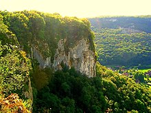
The Cuisance has two short source streams that arise in the Reculée des Planches landscape in the municipality of Les Planches-près-Arbois and join in the village. The two karst springs Grande Source de la Cuisance (German: Great source of the Cuisance, also called the eastern source) and Petite Source de la Cuisance (German: Small source of the Cuisance, also called the southern source) are located in the imposing cliff end of the Cirque du Fer à Cheval (German: horseshoe kettle ). The catchment area of the springs is the karst , wooded plateau area .
The Kleine Cuisance is 1.7 km long and rises south of Les Planches-près-Arbois at the lower edge of the horseshoe basin in a natural forest reserve . Its stream bed, which runs northwest to north, is marked below the source by large occurrences of sintered steps made of tuff stones , which also form the striking Cascade des Tufs waterfall .
The 750 m long Große Cuisance rises directly from a high rock face east of the village of the spring cave Grotte des Planches . It unites in the village with the Kleine Cuisance coming from the south.
After the confluence of the source brooks, the Cuisance meanders with a slight gradient to the northwest and overcomes some rapids between Mesnay and Arbois . In the municipality of Souvans , the Cuisance flows into the Loue as a left tributary .
Tributaries
- Ruisseau du Grand Mont (right)
- Engraving (left)
- Ruisseau Javel (right)
- Ruisseau d'Orgevaux (left)
- Glanon (left)
- Ruisseau des Prés Champonnet (left)
- Bief Magnin (left)
- Bief Bouchot (left)
- Verine (left)
- Vieille (right)
- Bief Roselet (left)
Places on the river
Attractions
- Grotto des Planches , spring cave at the exit of the Grande Source de la Cuisance
- Cascade des Tufs , waterfall at the Petite Source de la Cuisance stream
Web links
Remarks
- ↑ Source geoportail.fr (1: 16,000)
- ↑ estuary geoportail.fr (1: 16,000)
- ↑ a b The information on the length of the river is based on the information about the Cuisance at SANDRE (French), accessed on October 17, 2011, rounded to full kilometers.


